This article comes to us courtesy of California Watch
This week, the U.S. Geological Survey added 13,688 historical California topographic maps to its online archive, hundreds of which date back to the 1800s. From the Gold Rush town of Downieville in the Sierras to El Cajon in the hills above San Diego Bay, the maps provide a picture of California from before the 20th century through the past decade.
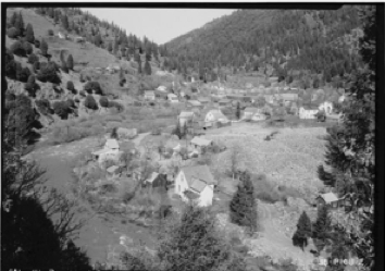 Library of CongressA 1934 photo shows historic buildings from the Gold Rush era in Downieville.
Downieville sits on the North Fork of the Yuba River in Sierra County, where gold was plentiful in the mid-1800s, according to the Sierra County Chamber of Commerce. In 1851, the town had a population of 5,000 people, only 25 of them women, according to a National Park Service history. On the USGS map surveyed in the late 1800s, the Goodyears Bar sits along the river just down the hill from the Pliocene mine and about 12 miles or so from Whiskey Diggings. The population boom brought on by the Gold Rush made it one of the biggest towns in California, and it missed becoming the capital by one vote, according to the chamber.
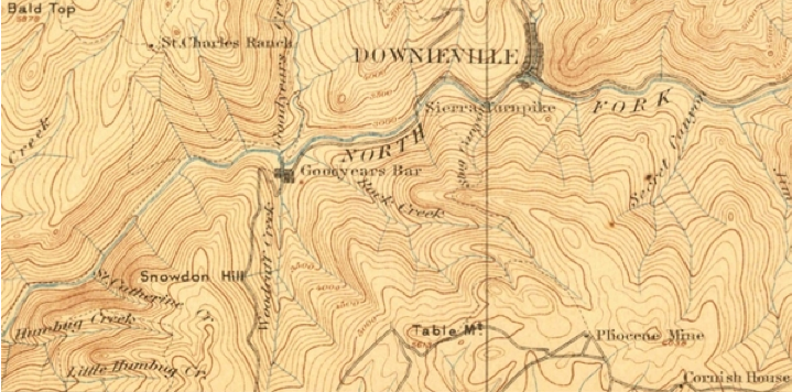 U.S. Geological SurveySurveyed 1885-1888
In the southern part of the state near the Mexican border, El Cajon sat 18 miles east of San Diego in 1886 and was a booming agricultural town, according to an account [PDF] in the San Diego Union at the time.
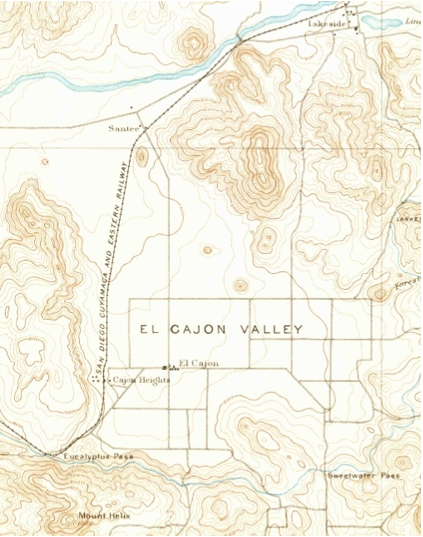 U.S. Geological SurveySurveyed in 1891
There are more than 3,000 places in California covered by the maps in the archive, with 28 maps of Truckee dating from 1891 through 2000. Situated east of Donner Pass along the Truckee River, the town of Truckee was along the Central Pacific Railroad line in 1891. The 2000 map focuses mostly on the town but still shows the location of the saw mill that appears on the map made more than a century earlier.
"These maps harken back to California's past, when its awesome topography could make a simple trip for staples a daylong journey in a horse-drawn buckboard," USGS Director Marcia McNutt said in the announcement. "The uses of these maps for scientists, historians, educators and even by those who simply want to be reminded of a time when life moved a little slower are limited only by our imagination."
Agustin Armendariz is an investigative reporter for California Watch, a project of the non-profit Center for Investigative reporting. Find more California Watch stories here.