
Within a week, Google rolled out two updates to Google Maps that should make efficient traveling a little bit easier.
The service now shows estimated travel times based on real-time traffic data (in addition to historic traffic data) and features typical traffic patterns for both highways and major roads in world cities like London, New York, San Francisco and others.
On April 2, Google made a feature available that can show typical traffic patterns for major roads in addition to highways. All users have to do after entering their journey's start and end points is enable the traffic layer in the upper right hand corner of the map and click change to view traffic patterns either in real time or at a specific date and time.
LOOK:

According to The Next Web, the service had always provided typical traffic patterns for highways but is just now being updated to show the information for major roads, too.
The site also mentioned that these updated features are made possible by "various bits of data, including some gathered from the My Location feature on Google Maps for Android as a part of its crowd-sourced data gathering efforts," which Google began back in 2009.
Previously, on March 29, Google announced in a blog post that users will be able to view an estimate of how long a trip may take, based on both live and historic traffic data. Wrote Google Maps software engineer Szabolcs Payrits:
In areas where the information is available, this new and improved feature evaluates current traffic conditions and is constantly being refreshed to provide you with the most accurate, up-to-date estimate possible.
According to PCMag.com, the company used to show similar trip time estimates up until last summer, but a Google spokesperson told the site that the information had been based solely on historic traffic data -- rather than on both historic and real-time traffic data -- and so was eventually removed.
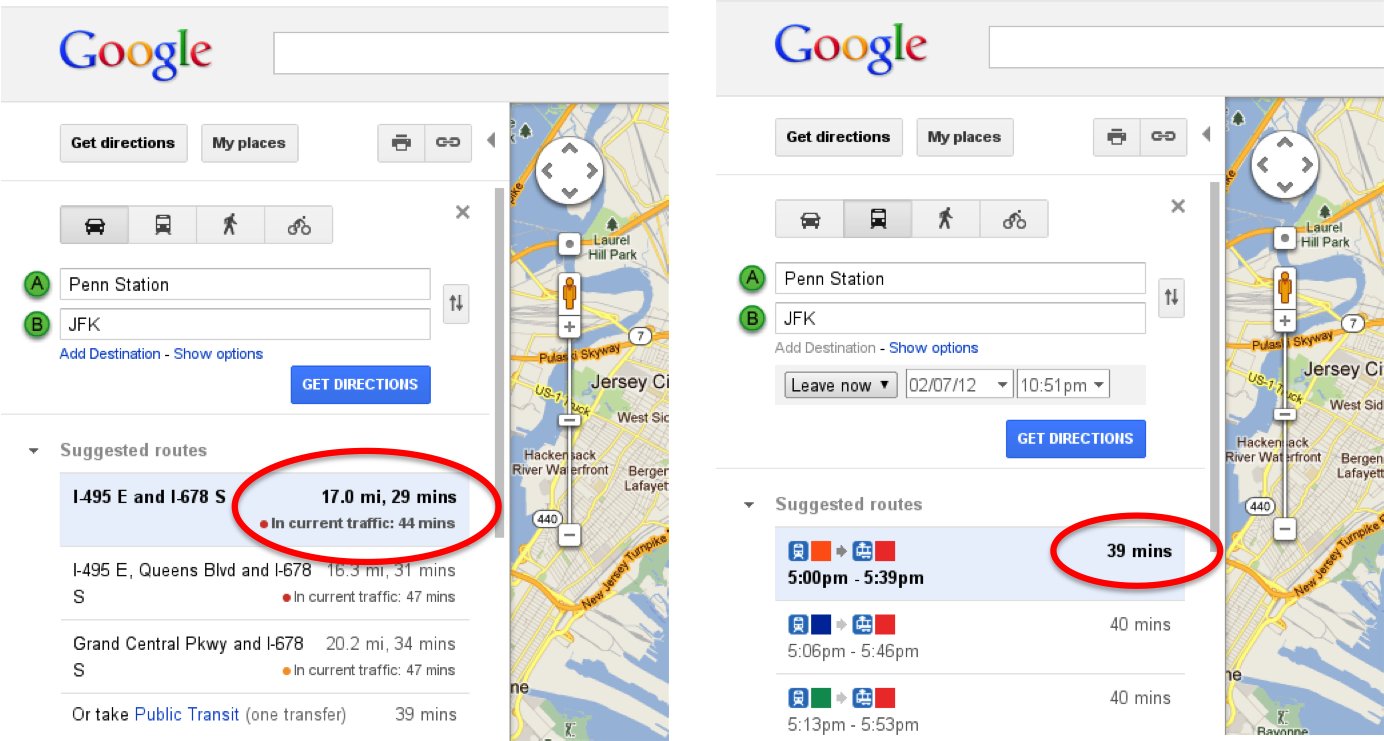
As shown in the photo below, the estimated travel time based on real-time traffic conditions is shown right below the estimated time based on historic traffic data. Switching travel mode from car to train will allow users to easily find out which vehicle will get them to their destination more quickly.
LOOK:
Do you think these latest Google Maps updates will be helpful? Let us know in the comments!
Related
Before You Go
