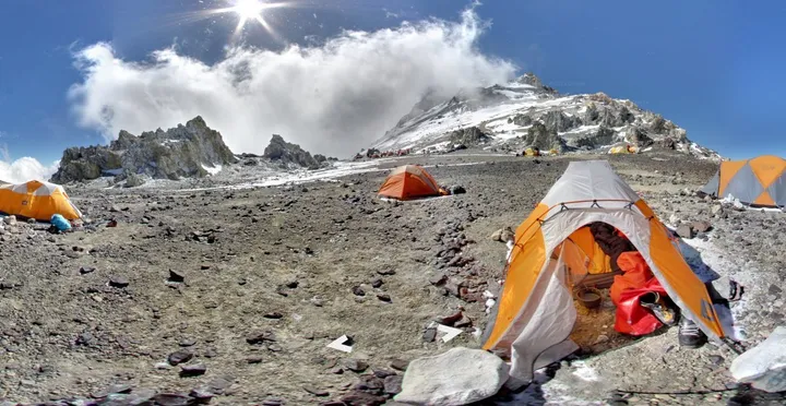
Google's Street View already offers breathtaking views of the Grand Canyon, Antarctica and the Great Barrier Reef. Now the 360-degree panoramic imaging service is inviting you to scale four of the world's tallest mountains -- without leaving your house.
Here's how Google captured these latest locations.
Over the past 18 months, Google Innovation Lab employee Dan Fredinburg hiked Mt. Kilimanjaro, Mt. Elbrus (in the Caucasus), Aconcagua (in the Andes) and part of Mt. Everest. Fredinburg packed a digital camera, a tripod, and -- of course -- a fisheye lens to snap the photos needed to stitch together a Street View of the mountains.
According to a post on the Google Blog, the equipment used by Fredinburg and his team was relatively lightweight. (It's the same gear that gets used for Google's Business Photos feature, the indoor version of Street View.) As Wired points out, a DSLR and tripod is a lot lighter than the 40-lb Google Trekker backpack that the company used to put the Grand Canyon on Street View last year.
Rather than photographing every foot of the trails, Fredinburg chose a few picturesque sites on each mountain. So while you can't scale an entire peak via Street View (yet), we're pretty satisfied with these stunning views.
Check out the slideshow below to see for yourself.