Happy Earth Day! Every year on April 22, the world celebrates this amazingly diverse planet we call home, focusing on ways to protect it from the often destructive practices of its human inhabitants. While many of these efforts focus on the conservation of Earth's most fragile habitats, we frequently forget just how extreme and alien-like our own planet can be. The photos below showcase Earth's unbelievably varying landscapes and remind us that we often live our lives confined only to a minuscule part of this amazing planet.
Giant's Causeway, Northern Ireland
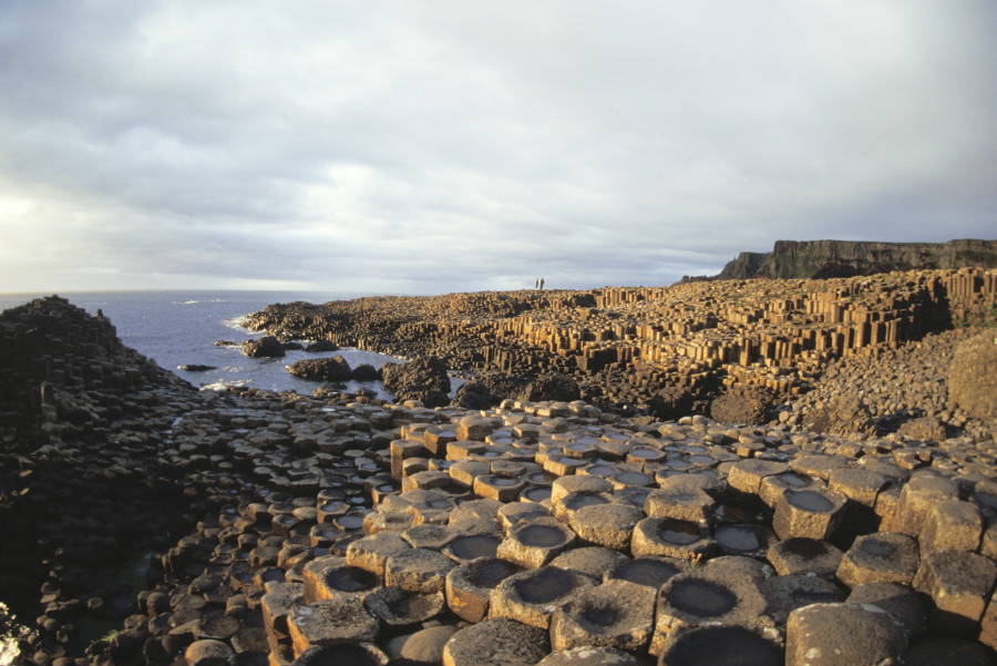
This strange landscape was formed around 50 to 60 million years ago. The geometric features are actually basalt columns that fractured into these shapes after a volcanic eruption, though legend has it that they're the remnants of an ancient road built by a giants. (Photo: Education Images/UIG via Getty Images)
Svartifoss, Iceland
The same type of features are found here, in Iceland, where they play host to a frigid waterfall.
Fingal's Cave
And here, on the island of Staffa, in Scotland.
Sahara Desert, Libya
Shifting textures of the sand in the Sahara Desert, the largest sand desert in the world at over 3,600,000 square miles, somehow resemble human features.
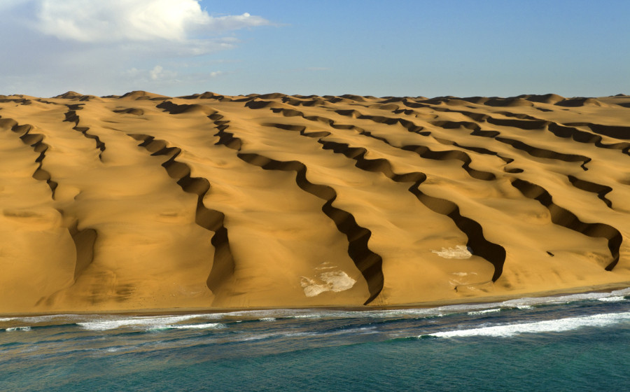
Sand Dune, Namibia
This massive dune in the Namib Desert blocks light to one side of the slope, showcasing a stark contrast in an often unchanging desert landscape.
Skeleton Coast, Namibia
On the west coast of Africa, the desert and its dunes run right up to the Atlantic Ocean. (Photo: David Yarrow Photography via Getty Images)
Grand Prismatic Spring, Wyoming
The bacteria and microbial mats that thrive in this naturally heated pool change colors depending on the temperature of the waters.
Abraham Lake, Alberta, Canada
Frozen ice bubbles are seen trapped beneath the surface of a lake.
Ice Cave, Washington State
Melting and refreezing has created an alien-like texture on the ceiling of this cave.
Lake Baikal, Russia
Thick cracks are seen in the ice of Lake Baikal, the deepest and largest freshwater lake in the world in terms of volume. The lake plummets to nearly a mile deep in one of its basins.
The Wave, Arizona
This iconic sandstone rock formation is the result of millions of years of erosion by water and now primarily wind.
Bryce Canyon, Utah
These jagged red rocks form the spectacular Bryce Canyon amphitheaters. The widely varying topography was formed by weathering and erosion of less resilient sedimentary layers.
Canyonlands National Park, Utah
Millions years of erosion have carved a wide variety of gorgeous features into this vibrant landscape.
Chocolate Hills, Philippines
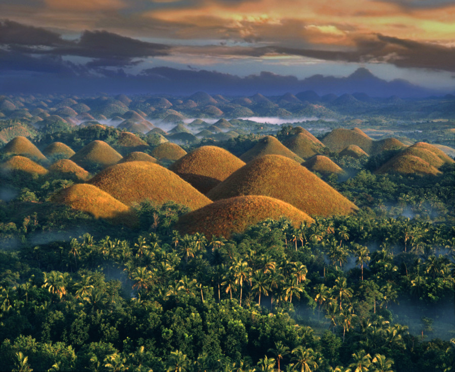
More than 1,700 of these grass-topped limestone hills may dot the Bohol Province in the Philippines, millions of years after being weathered by erosion. The domes range in size from around 100 feet to 160 feet tall. (Photo: Per-Andre Hoffmann via Getty Images)
The Pinnacles, Australia
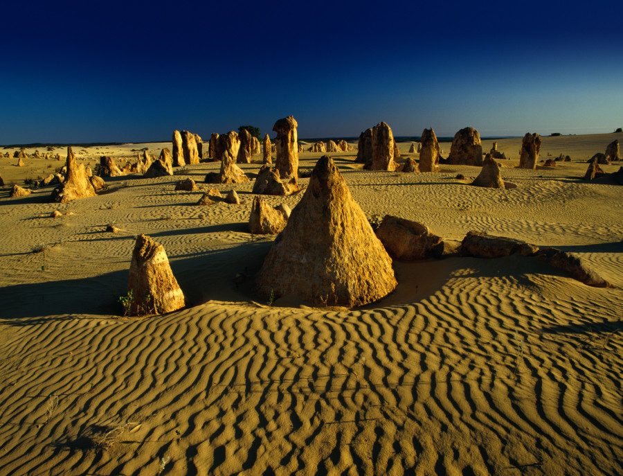
These ominous limestone formations are a big draw in Western Australia. While science has come to an agreement that they are made of the remnants of sea life at the bottom of what was once a vast ocean, there are some conflicting theories about why these specific spires are so far above ground. (Photo: Richard I'Anson via Getty Images)
Zhangjiajie, China
The renowned pillars in Hunan Zhangjiajie National Forest Park are the subject of both Chinese art and Western cinematography. The spires served as an inspiration for the alien world in the blockbuster film "Avatar."
Nubra Valley, India
This desert-scape high on the Tibetan Plateau is home to some of the most stunning slopes you'll find on Earth.
Tsingy de Bemaraha National Park, Madagascar
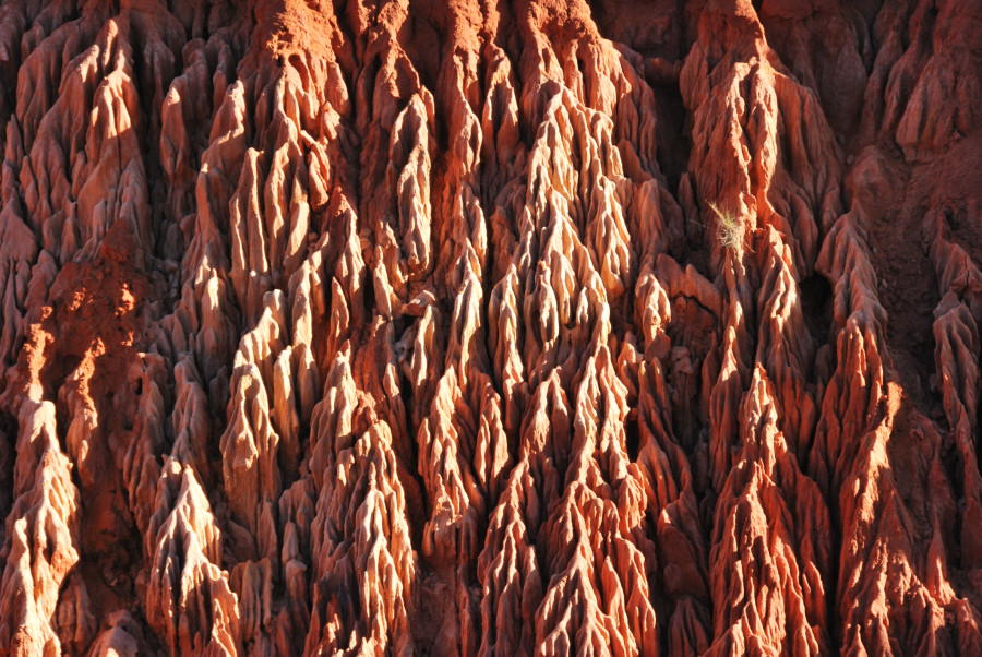
Erosion has carved the land on this part of the African island into a remarkable stone forest. Much of the wildlife found in this area lives nowhere else in the world. (Photo: Haja Rasambainarivo via Getty Images)
Mono Lake, California
With no access to freshwater, the water in this shallow lake is highly salty and alkaline, a result of the erosion of minerals that make up the surrounding geologic layers. Beginning in the middle of the 20th century, Los Angeles began diverting water from Mono Lake for use. It drained much of the lake's waters, exposing the now-iconic tufa towers seen in the photo above.
Mount Nyiragongo Volcano, Congo
At least 34 eruptions have been recorded at this highly active volcano since 1882. It contains the largest known lava lake in the world.
Lava Flow, Hawaii
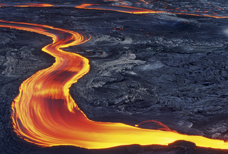
Molten lava from the Kilauea Volcano streams toward the ocean. (Photo: G. Brad Lewis via Getty Images)
Volcano, Iceland
Runoff from a volcano flows down a bed and into the water.
Er Wang Dong Cave, China
This enormous cave in central China is so large that it houses its own weather system -- meaning clouds and rain can appear below ground.
Death Valley, California
A storm moves in over the salt flats in barren California.
Uyuni Salt Flats, Bolivia
The Salar de Uyuni are the largest salt flats in the world. The near-uniform topography makes for amazing sight-lines and great photo-ops.
More Uyuni Salt Flats
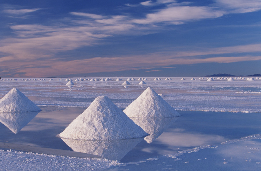
Though photographers don't always use human subjects. (Photo: Art Wolfe via Getty Images)
Dallol Volcano, Ethiopia
At 150 feet below sea level, this is the lowest known volcano on land. Acidic discharge from the geologic activity has bleached the land in all sorts of extreme colors.
A Closeup Of Dallol Deposits
Around 50 years ago, a mining settlement of the same name was occupied just a few miles from this harsh terrain. It was abandoned in the 1960s, though holds records for being one of the hottest continuously inhabited places on Earth.
The Richat Structure, Mauritania
This enigmatic geological feature in the heart of the Sahara desert (seen here from space) has been the subject of much debate among scientists. Once thought to be an impact crater, geologists now consider it to be a deeply collapsed dome that was initially formed around 100 million years ago.
Related
Before You Go
