The numbers prove that Harvey was a monstrous storm.
Harvey dumped an estimated 27 trillion gallons — that’s a “T” — of rain over Texas and Louisiana in a six-day period, with some locations seeing more than 4 feet. An estimated 100,000 homes have been damaged and at least 34,000 people are currently in shelters. Researchers have calculated it to be a 1-in-1,000-years flood event.
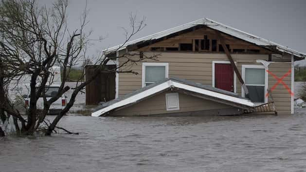
Photos of the catastrophic storm have gripped the nation.
DigitalGlobe — a private space imagery company — on Thursday released a collection of jaw-dropping before-and-after satellite images that show the monumental scale of the flooding in Houston and the surrounding areas.
Advertisement
Below, a look at several inundated Texas towns.

DigitalGlobe
Brookshire flooding

DigitalGlobe
Rosenberg flooding

DigitalGlobe/ScapeWare3d/Getty Images
Satellite imagery of the San Jacinto River basin following Hurricane Harvey
Advertisement

DigitalGlobe
Angleton flooding

DigitalGlobe
Wharton flooding

DigitalGlobe
Holiday Lakes flooding
Advertisement

DigitalGlobe/ScapeWare3d/Getty Images
Beaumont flooding

DigitalGlobe/ScapeWare3d/Getty Images
Simonton flooding

DigitalGlobe/ScapeWare3d/Getty Images
Houston flooding
Advertisement

DigitalGlobe/ScapeWare3d/Getty Images
Simonton flooding
Related
Before You Go
