Autumn comes early to the Colorado high country. The late bloomers can no longer compete with the crescendo of leaf color that is the finale of this season of plant life. Soon the colors will fade to brown, blue and white as a deep snowy tarp preserves the genetic potential of spring. The cycle will repeat and thanks to natural selection each iteration will reveal minute increments of evolutionary progress.
I went to peek in at fall in the Brainard Lake Recreation Area ($8 fee/5 days) and capture some large panoramic photos. Here above 10,000 feet/3048 meters the fall finale is well under way. To get there I took County Road 102 west from the Peak-to-Peak Highway (SR 72).
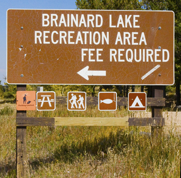
Brainard Lake Sign on Peak to Peak Highway
On the way up to the recreation area the road is flanked with turning aspens heralding the arrival of autumn...
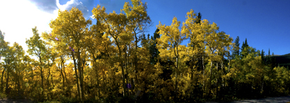
Aspens Herald the Arrival of Autumn
At the end of CR 102, I circled Brainard Lake to the junction for the Long and Mitchell Lake parking areas. I continued to the Long Lake turnoff (to the left) and the parking area where a .25 mile hike leads to the junction of the Jean Lunning trail and the trails heading toward Lake Isabelle and Pawnee Pass. First I headed left (south) to the Jean Lunning Trail...
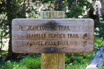
Jean Lunning Goes South while Isabelle Glacier Is North
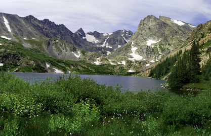
After a few steps I crossed the bridge over the outlet of Long Lake and found a spot for a panorama of the lake with the Indian Peaks to the west at GPS 40.075313,-105.587325...
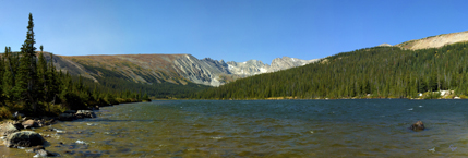
Indian Peaks from Long Lake
Our next photo stop will be higher up on the Niwot Ridge Trail for an overview of the area. The Niwot Ridge Trail heads south from the Jean Lunning Trail after a few hundred yards beyond this boardwalk. This area was filled with wildflowers in late July...
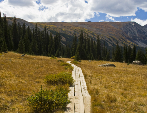
The Jean Lunning Trail Boardwalk with Niwot Ridge in Background
Here you will find the Niwot Ridge Trailhead. This way up...
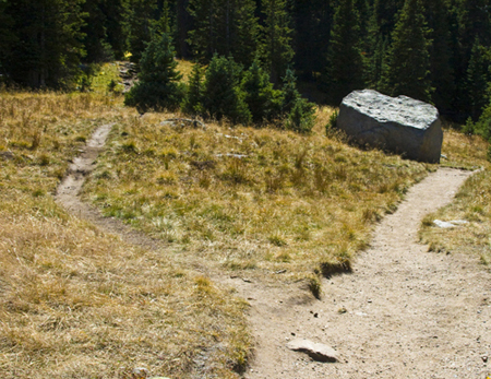
The Unmarked Niwot Ridge Trail
The trail enters a dense spruce forest at the base of Niwot Ridge and climbs up a series of switchbacks...
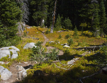
The Trail Winds Through Lush Forest
Here's where the last of the late-blooming arnica are attracting nectar-starved bees...
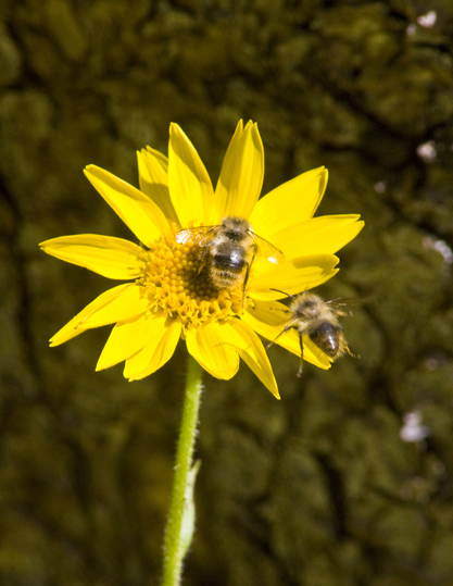
Bees on Last Heartleaf Arnica (Arnica cordifolia) Need Air Traffic Control
The pitch gradually steepens and the forest thins with rapidly improving views of the Long Lake basin and upper South St Vrain Creek valley. The trail clears the tortured pines of treeline before it eases through spacious tundra. As I approach treeline, tree growth becomes stunted, with trees growing on one side. If it is caused by wind, it is known as krummholz formation, from the German for "twisted wood."
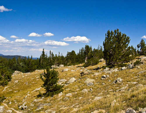
Approaching Treeline
Here's a remarkable tale from this trail. Our own Niwot Ridge is a U. N. International Biosphere Reserve for arctic and alpine research. The University of Colorado maintains a Mountain Research Station at this site. The Preserve has been selected by the National Science Foundation as the alpine tundra component of the national Long-Term Ecological Research (LTER) program, which consists of 26 sites. The Niwot Ridge LTER is operated by the University of Colorado's Mountain Research Station, part of the Institute of Arctic and Alpine Research. Be sure to check out their live TundraCam.
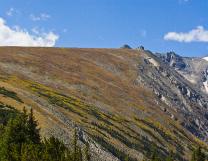
Fall Color Comes to World Class Niwot Ridge Tundra
I cleared the trees to take this fall panorama of the Indian Peaks and Long Lake below...
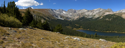
A View from the Ridge
Here's a long telephoto image of Isabelle Glacier from this vantage point reveling an avalanche...
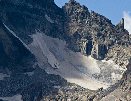
Isabelle Glacier
The quest for my next photo took me back down to the other (north) side of Long Lake and west on the Pawnee Pass/Isabelle Glacier Trails to Lake Isabelle. The trail skirts the south shore of lake and heads up the basin towards the Indian Peaks and the Pawnee Pass through the Continental Divide. The basin is filled with fall color...
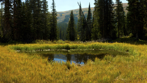
A Reflecting Pool On the Way To Lake Isabelle at GPS 40.071329,-105.604349
Further west of Long Lake the South St. Vrain Creek affords another panoramic vision of the Indian Peaks at GPS 40.068581,-105.609598...
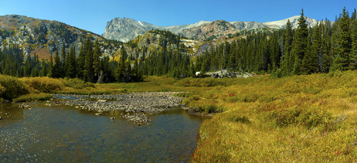
Indian Peaks from South St. Vrain Creek
After a short climb I approach the lake's eastern crest...
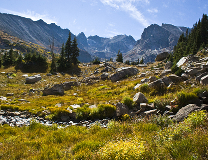
Approaching Lake Isabelle
...to arrive at my final photo destination at Lake Isabelle. Here the Indian Peaks are just a few miles west. Although the lake is drained for agricultural irrigation in late August (where's the drain?) this imposing backdrop makes a sweeping panoramic view at GPS 40.070551,-105.616829...
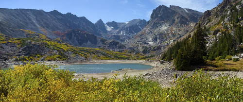
Somewhat Drained Isabelle is Still A Beautiful Destination
For reference, here's what the Lake looked like from this same point when filled...
Captured with H2O on 05 August 2009 1:40pm
On my way back to the trail head I suddenly ran into an old friend with big antlers...
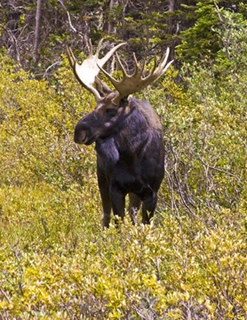
Bullwinkle J. Moose (Alces alces)
...who briefly posed for a photo before going on to an appointment at the lake...
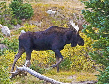
On to a Business Meeting at the Lake