
Britain hasn't been successfully invaded since 1688, and then, nobody tried to burn the files, which means that the pack rats at the archives have almost a thousand years worth of stuff lying around. Among these are various forms of political propaganda, both for and against the governments of the day. Some of this stuff is considered art, and this summer, two museums, the British Library and the Tate Gallery, both in London, are mounting exhibitions of some of the best.
The first of these is the British Library's monumental "Magnificent Maps: Power, Propaganda and Art, " which mostly focuses on the use of cartography as propaganda and tool of intimidation.
The British government (the English government before the Act of Union in 1707) would use maps as wall decoration, with humongous prints or watercolors showing the world as it was known, or at least should have been known at the time.
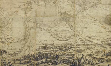
Monumental maps, which are mostly the only kind that were shown, were sent by kings and princes to each other to show the domains they were masters of, a form of preening that could be sent through the post. A large map of one's kingdom (or Dukedom or whatever) will show to the hereditary leader of the next country over that you are wealthy and should be feared.
One of the more interesting pieces is a 8-by-10 foot map of Pomerania, showing the kingdom in great detail, with portraits of the King and his close relations at the corners. Unfortunately, there were problems with the printing process and it didn't come out until their neighbors had already conquered and dismembered the place, leaving nothing but the map.
Sometimes, cartographers, or their patrons, would use their works to make a plea or suggestion. There was a globe produced in the 1580s, which showed North America as entirely British... Elizabeth the First didn't quite take the hint, but her successor, James the First most certainly did. There is also an extremely beautiful (and scary) German map produced by Rudolph Koch for Hitler in 1933, which showed what Koch and his Fürer thought at the time that Germany should look like.
Dr Peter Barber, who curated the exhibit, said that had Neville Chamberlin seen the map, he wouldn't have given Hitler the Sudetenland in 1938 and World War II wouldn't have happened.
Some of the "cheaper" maps, made for schools town halls and the like, were even more propagandist. The second oldest map there was for schools and was totally inaccurate, but the message was clear: the king of England was ruler of all the good parts of the world, and most of the rest didn't matter.
Aside from the "I'm master of my domain" angle (there's a number of ornate maps of individual properties, suitable for one's living room), the political commentary angle is also played up. Posters from all over Europe use cartography as part of the iconography, because since at least since the 19th century, most people know what their own country looks like, and the enemy chomping on a silhouette of Britain or Russia is a powerful or clichéd image that works every time. Finally, there's Stephen Walter's "The Island," (2008) drawn with what appears to be a ballpoint pet; it is huge, and purports to show that London is a world all it's own and not actually part of England (somewhat like saying New York isn't really part of the U.S.). The work has been digitized, and the "Where's Waldo?" like details can be seen with a remarkable digital "magnifying glass."
In Part 2, we go to the Tate's delightful "Rude Brittania" exhibition, which shows the history of political cartooning.
Magnificent Maps: Power, Propaganda and Art is at the British Library, Euston Road, NW1, from April 30 to September 19