
Remember when you had to rely on seeing just a part of yourself in the reflection of a dark lake or in a small expensive piece of polished copper or silver-mercury? Probably not. I know that I, for one, take the highly reflective and often inexpensive modern mirrors for granted, not to mention the panoply of high-resolution cell phone cams, web cams and other photography and video cameras that can show us what we look like from head to toe at any given moment. Kim Kardashian West offers perhaps a good example of how ubiquitous "selfies" can be today - so easy to access that she can post many dozens each week across her social media accounts, not to mention create an entire book out of them.
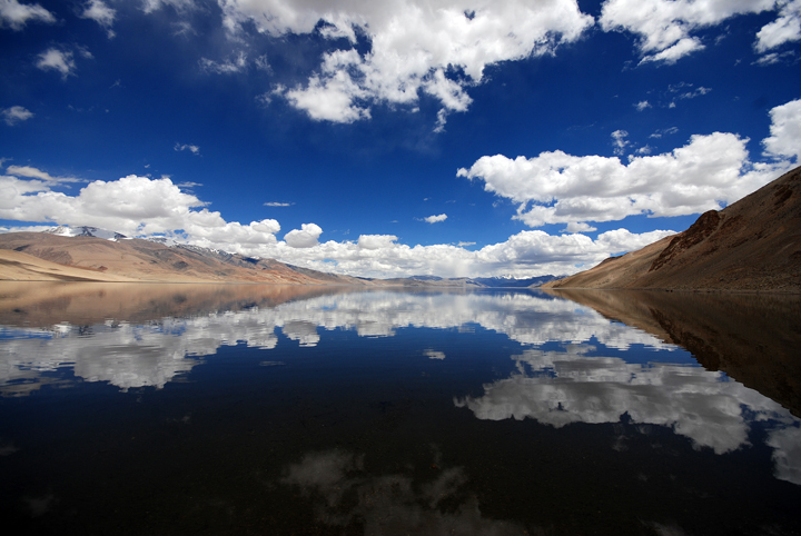
On the calm top of a lake, a clear reflection is produced. Credit: Prabhu B Doss
If you go back just a handful of decades however, our home planet, Earth, was unable to get a full well-lit view of itself (and good lighting, as Kim Kardashian West knows, is everything). Earth is a pretty decent size for a terrestrial planet at about 4,000 miles in radius with a total surface area of about 200 million square miles. To get a good full-body shot of something that large, the camera taking the planet-sized selfie has to be far enough away from Earth to get the entire planet in the shot, which could be between about 25,000 miles and a million miles away. To achieve the best lighting conditions, the camera also has to be positioned in between the lighting source (our Sun) and the subject (Earth).
Having gone many thousands of years without humans being able to see their own whole planet, it is perhaps unsurprising how much of a hit the very first well lit, high-resolution, full-body views of Earth were. As the space race raged on in the mid-20th century, we approached the possibility of shots of Earth from above. In 1946, for example, a rocket-launched camera provided us with a grainy black and white view of part of North America. In 1967, the ATS-III satellite, launched to study scientific, communications and meteorological issues primarily, provided a full-disk color view of Earth. In 1968, citizens of the planet were treated to a full-color view of a little more than half of Earth as seen from a NASA spacecraft that was orbiting the moon for the Apollo 8 mission.
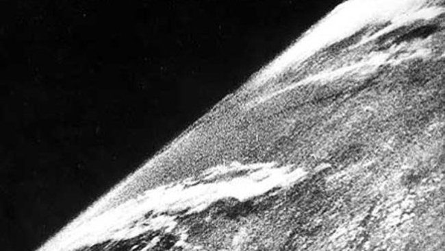
Earth from above in 1946. Credit: White Sands Missile Range/Applied Physics Laboratory
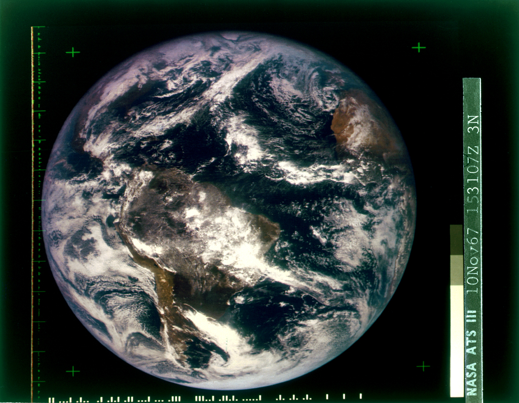
A full-view color Earth from ATS-III in 1967. Copyright: University of Wisconsin System Board of Regents
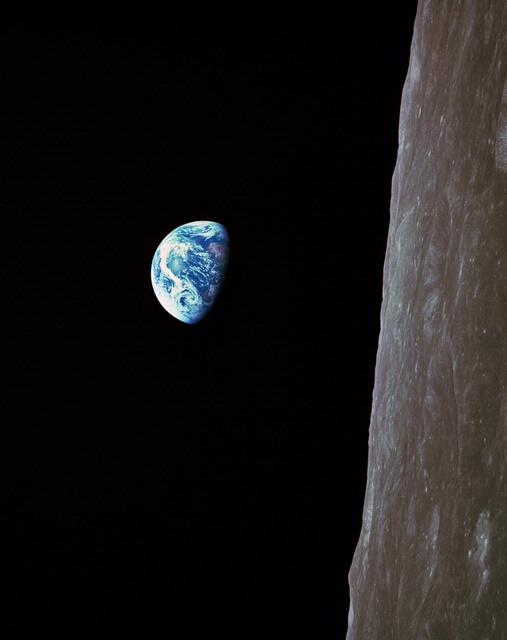
Partial Earth from the Apollo 8 mission, 1968. Credit: NASA
Other shots followed, but it was in 1972 that an astronaut from the Apollo 17 mission captured this striking high-quality full-disk image of Earth from about 28,000 miles away using one of the three 70-millimeter Hasselblad cameras on board. That image lit a spark in the imaginations of many, and has remained a classic over four decades. Full-disk Earth images have been used to not only understand our home base better, but also, according to many, for rallying people around environmental awareness.
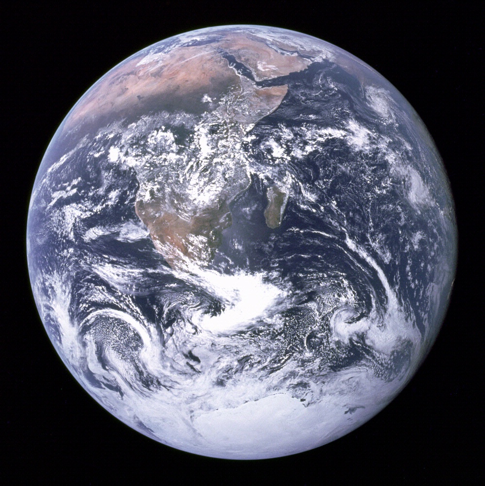
Earth from the Apollo 17 mission, 1972. Credit: NASA
Humans have, certainly, been gifted many other views of Earth in between the early shots taken over half a century ago and now. The Blue Marble and Black Marble series of images were composited from many datasets of an orbiting satellite (around 500 miles away). More distant images of Earth were captured by the Lunar Reconnaissance Orbiter from the Moon at a distance of over 200,000 miles away. There has also been a treasure trove of beautiful and more intimate images of the details of our planet photographed by astronauts on board the International Space Station (250 miles above Earth). Each of these images has provided more information about our singular location in the Universe.
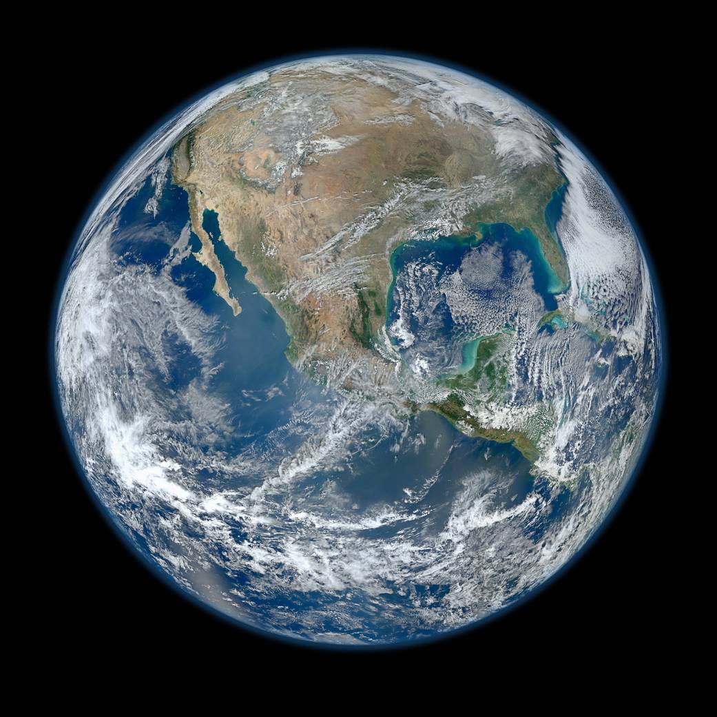
NASA's "Blue Marble" composite Earth image showing North America, 2012. Credit: NASA/NOAA/GSFC/Suomi NPP/VIIRS/Norman Kuring
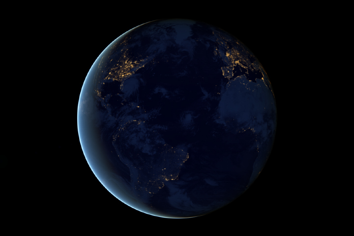
NASA's "Black Marble" composite Earth at night image over the Atlantic Ocean, 2012. Credit: NASA Earth Observatory image by Robert Simmon, using Suomi NPP VIIRS data provided courtesy of Chris Elvidge (NOAA National Geophysical Data Center). Suomi NPP is the result of a partnership between NASA, NOAA, and the Department of Defense.

Half-daytime and half-nightime image of Earth, showing Asia (composited day/night views) Credit: Data-AVHRR, NDVI, Seawifs, MODIS, NCEP, DMSP and Sky2000 star catalog; AVHRR and Seawifs texture-Reto Stockli; Visualization-Marit Jentoft-Nils
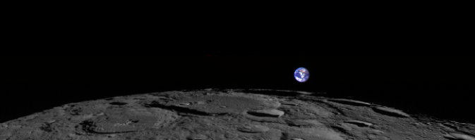
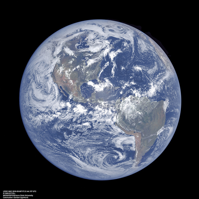
Lunar Reconnaissance Orbiter images of Earth, taken in 2010. Credit: NASA/Goddard/Arizona State University (top) and NASA / GSFC / ASU / colorized by Gordan Ugarkovic (bottom)
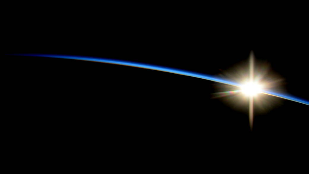
Sunrise from Space, taken by astronauts on board the International Space Station in 2014. Credit: Credit: NASA/Reid Wiseman
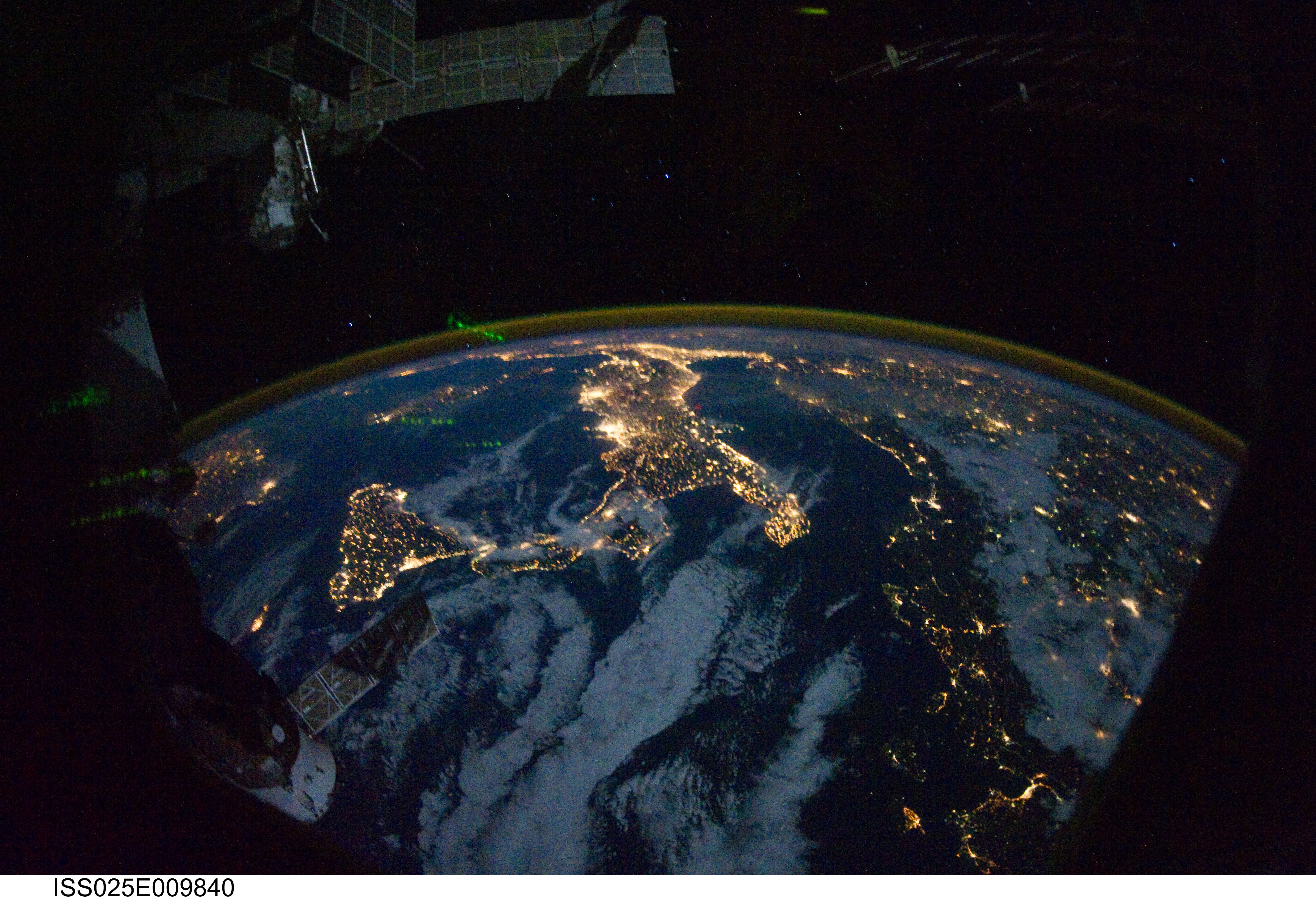
Parts of Europe and Africa at night, taken by astronauts on board the International Space Station in 2010. Credit: NASA/JSC
With all of the space-based satellites humans now have up in orbit around our planet (and many others even beyond), it may seem surprising that only as recently as 2015 did we have a spacecraft in a sweet spot -- about a million miles away, or four times the distance of our Moon's orbit -- dedicated to capturing full-color, full-view shots of Earth. But with the successful launch and deployment of NASA's DSCOVR satellite this year, our planet can now join the selfie brigade.
Taking multiple full-disk images of Earth every day (as many as one every two hours - which might surpass even the Kardashian clan's output?), there will be a wealth of data to look at. These data go beyond visible light and will include infrared and ultraviolet light as well, making it a truly electromagnetic selfie. The information will be studied to better understand ozone and aerosols, ash from volcanic activity, atmospheric changes, and other topics important for climate study, communications and aviational impact, agriculture and more.
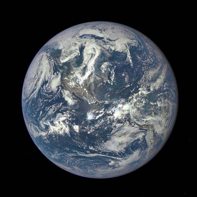
Our Earth from July 2015, via the DSCOVR mission. Credit: NASA
DSCOVR is about even more than "just" Earth selfies however. At its million-mile distance, DSCOVR is outside the Earth's magnetic environment and in a great location to study our Sun. Specifically, DSCOVR will be looking at the stream of particles that flows off of the Sun's surface, known as the solar wind, which is incredibly useful to humans in understanding our solar weather and predicting impacts from solar storms (think communications satellites down from geomagnetic disruptions for example).
In other words, this satellite might be able to tell us when a storm from the Sun really breaks the Internet, as opposed to a celebrity selfie that just seems to.
Kimberly Arcand and Megan Watzke are co-authors of "Your Ticket to the Universe: A Guide to Exploring the Cosmos" by Smithsonian Books and the upcoming book "Light: The Visible Spectrum and Beyond" by Black Dog & Leventhal.