
Extreme Ice Survey, the team featured in the Emmy award-winning film Chasing Ice, is aboard our ship, the National Geographic Explorer, in Antarctica. They're installing time-lapse cameras that will shoot photos every hour of every day, creating visual records of these changing landscapes.
The marked retreat of the Marr Ice Piedmont over the past few decades has literally changed the coastline of Anvers Island, a heavily glacierized island off the west coast of the Antarctic Peninsula and home to the U.S. Antarctic Program's Palmer Station. When Palmer Station began operation in the late 1960s, the ice was only a short distance behind the station and offered a range of recreational opportunities to the small station staff. Palmer Station has become a hub of Antarctic research over the intervening decades, yielding important insights on polar ecosystems and oceanography. All the while, the ice behind the station has been retreating, transforming the coastline and revealing new landscapes.

The Marr Ice Piedmont and Palmer Station seen from DigitalGlobe's World View 1 satellite, April, 2011. The white line indicates the extent of the Marr in 1975. ©2014 DigitalGlobe, Inc. 1975 extent data courtesy of Bob Farrell.
Last February, aboard the National Geographic Explorer, our team visited Palmer Station to scout locations for future camera installations. We landed on Amsler Island, a rocky outcrop ½ mile (0.8 km) across the ice choked Arthur Harbor from Palmer Station, and located a spot offering a commanding view of the Marr Ice Piedmont. Until 2004, this point was attached to the much larger Anvers Island and only as the ice front retreated was it revealed to be an island.
The clouds hung low over the bay during our visit last February and frequent snow squalls reduced visibility even further. Through breaks in the clouds, we observed a narrow isthmus of ice that tenuously connected a small bulb of ice to the main glacier. Less than a month after our departure, this narrow connection disappeared producing yet another island off the coast of Anvers Island. We're here now to install two time-lapse cameras to watch any future changes. It's a beautiful afternoon--light wind, partly cloudy skies and a comfortable temperature. The primary concern today is distraction. We are surrounded by a gorgeous amphitheater constructed of 90 foot-tall ice cliffs, while below, the slowly rising tide pulls along an abundance of bergy bits through the crystal clear waters of Arthur Harbor. If that's not enough, the near constant belching sounds of the elephant seals reminds us we are far from home.
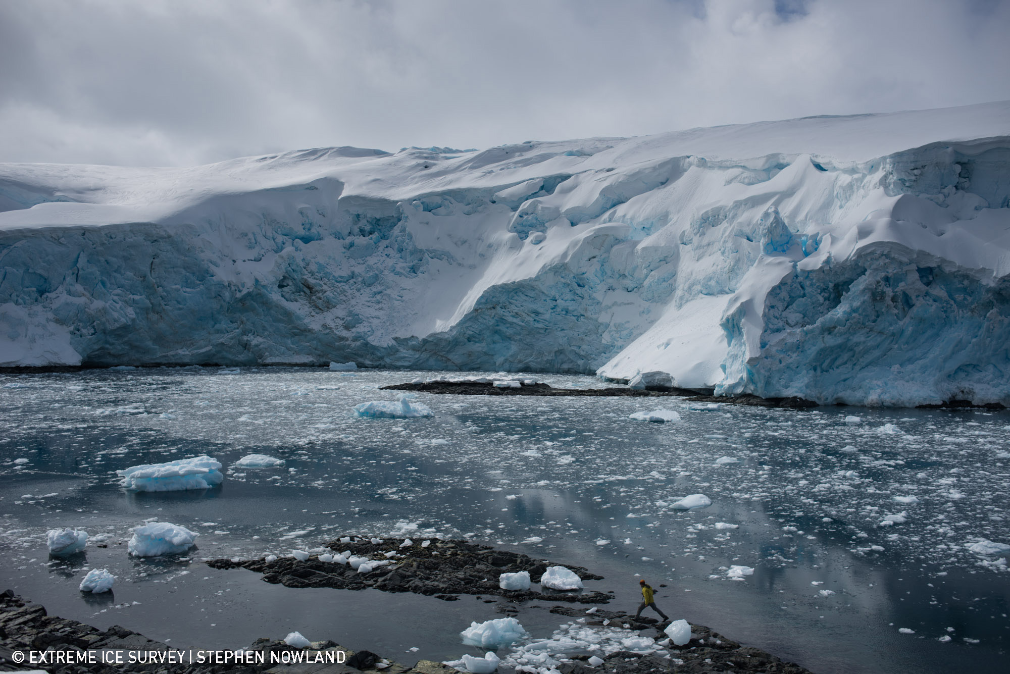
The jagged edge of the Marr Ice Piedmont towers above the frigid waters of Arthur Harbor. During the installation the familiar sound of calving seracs constantly echoed through the air. ©Extreme Ice Survey/Stephen Nowland
The installation, however, gets off to a rocky start. Matt starts drilling the first hole to anchor the camera post in place and the drill bit snaps. Perplexed, we muse that the bit must have been weakened by a previous incident that broke our primary drill, leaving us with this one and only back-up. And now, we're down to only two bits. Matt replaces the bit and starts again. Snap! The tip of the bit breaks off again. A solemn feeling comes over us--we only have one drill bit left and if it breaks, we're done.
Packing for polar expeditions is a difficult task, as you're constantly forced to decide on how many back-up items to bring--a delicate balance between weight and volume limitations juxtaposed with the reality that if a key item fails, the entire project is on the line. A trip to the hardware store just isn't possible.
Here we are, a calm day in the Antarctic, all of our gear in place and the installation hangs on this final drill bit. We take a deep breath and Matt starts drilling the holes--he skimps on each one to ensure they're all drilled, at least partially. A collective sigh of relief is aired as the final anchor is completed. The rest of the installation goes smoothly and we're back to the ship earlier than expected to celebrate our final camera installation on the Antarctic Peninsula.
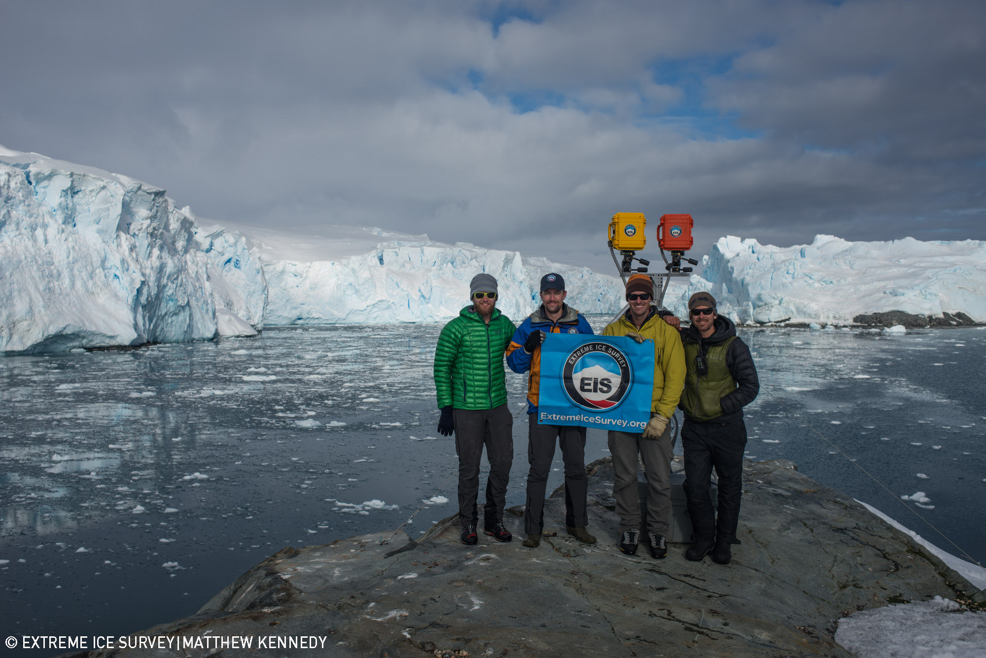
Matthew Kennedy, Stephen Nowland, Dan McGrath, and Eric Guth pose for an Extreme Ice Survey team portrait after the final two time-lapse camera installations of 2014. ©Extreme Ice Survey/Matthew Kennedy
By Dan McGrath, Extreme Ice Survey