By Jennifer Kingsley, Lindblad Expeditions-National Geographic naturalist, radio producer, and author of "Paddlenorth: Adventure, Resilience, and Renewal in the Arctic Wild."
A true adventure involves surprises, and sometimes they are more beautiful -- and alive -- than you could have imagined. For example, Ellesmere Island.
When National Geographic Explorer headed north last summer, Ellesmere wasn't on the itinerary, but when sea ice forced us to forge a new plan, it didn't take long for all of us polar types to agree: north, north, north!
Ellesmere is the northernmost island in the Canadian Arctic Archipelago. Its tip reaches 83 degrees north. We wrapped around its southeast corner and steamed towards the pole. We had two days to explore.
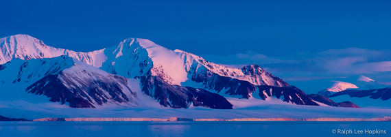
The coast of Ellesmere Island during long evening light. The bright glacier edge, where ice meets water, looks tiny, but it can be 10 stories high.
The edge of Ellesmere was like one continuous glacier. Ice flowed down every mountainside like icing off a warm cake. The edge of that ice, where it sheared off into the water, looked so thin and fragile. It wasn't until we got closer that I realized it was ten stories high.
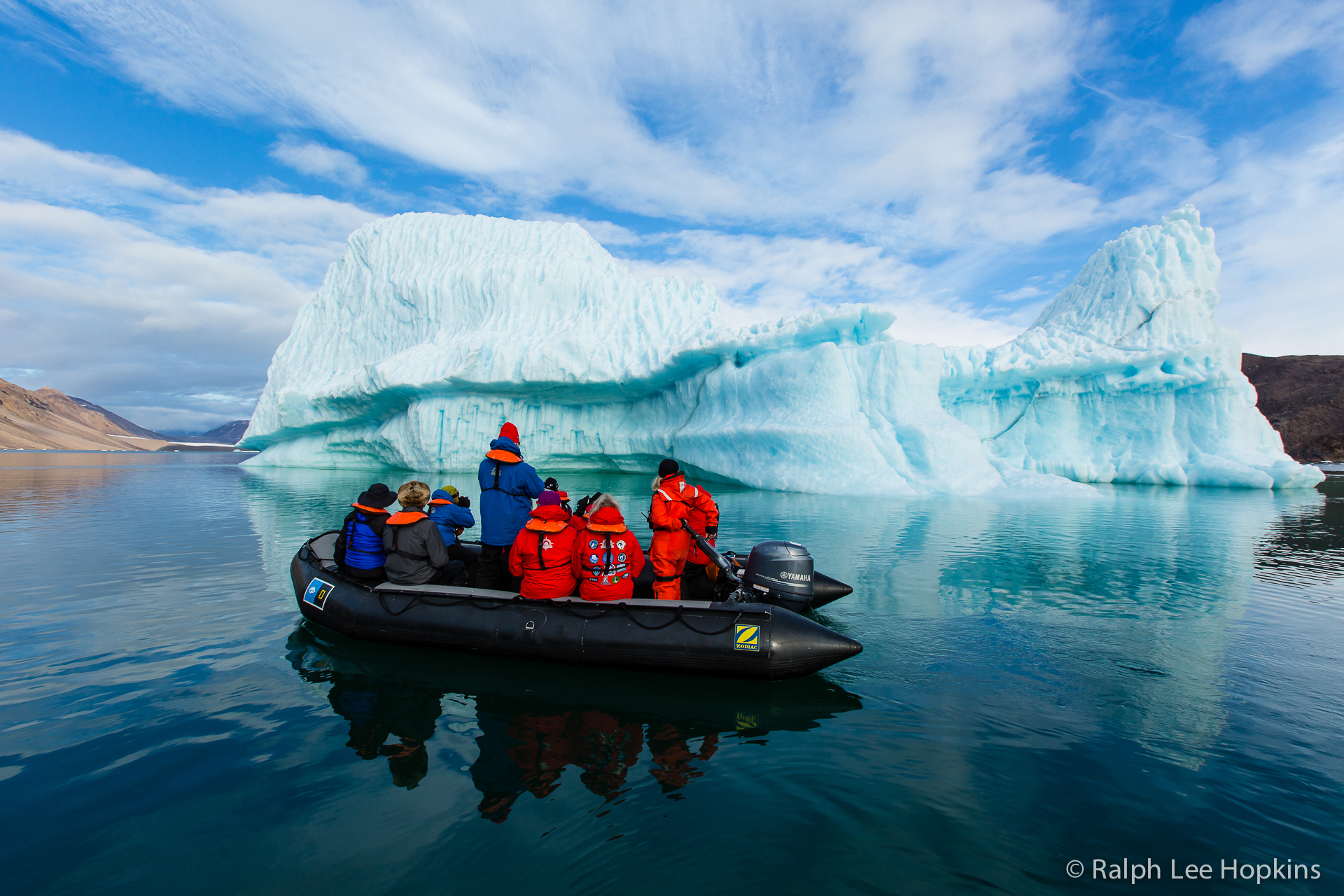
The first day was dedicated to the ice: hiking to it, cruising around it, finding places we could touch it. I counted 12 separate glaciers encircling the ship.

On our first day we explored ice in all its forms.
It wasn't until the second day that my vision of Ellesmere took on a new dimension.
I spent the second morning on the bridge with my roommate. She's a Viking archaeologist (these are the types you pal around with on the Explorer). We were admiring a mountainous island at the mouth of a fjord when she gasped its name, "Skraeling Island...it must be." We had reached place of pilgrimage for Viking lovers. We went on deck so I could take her picture.
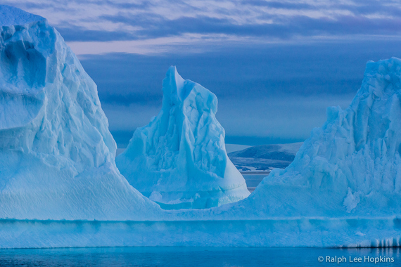
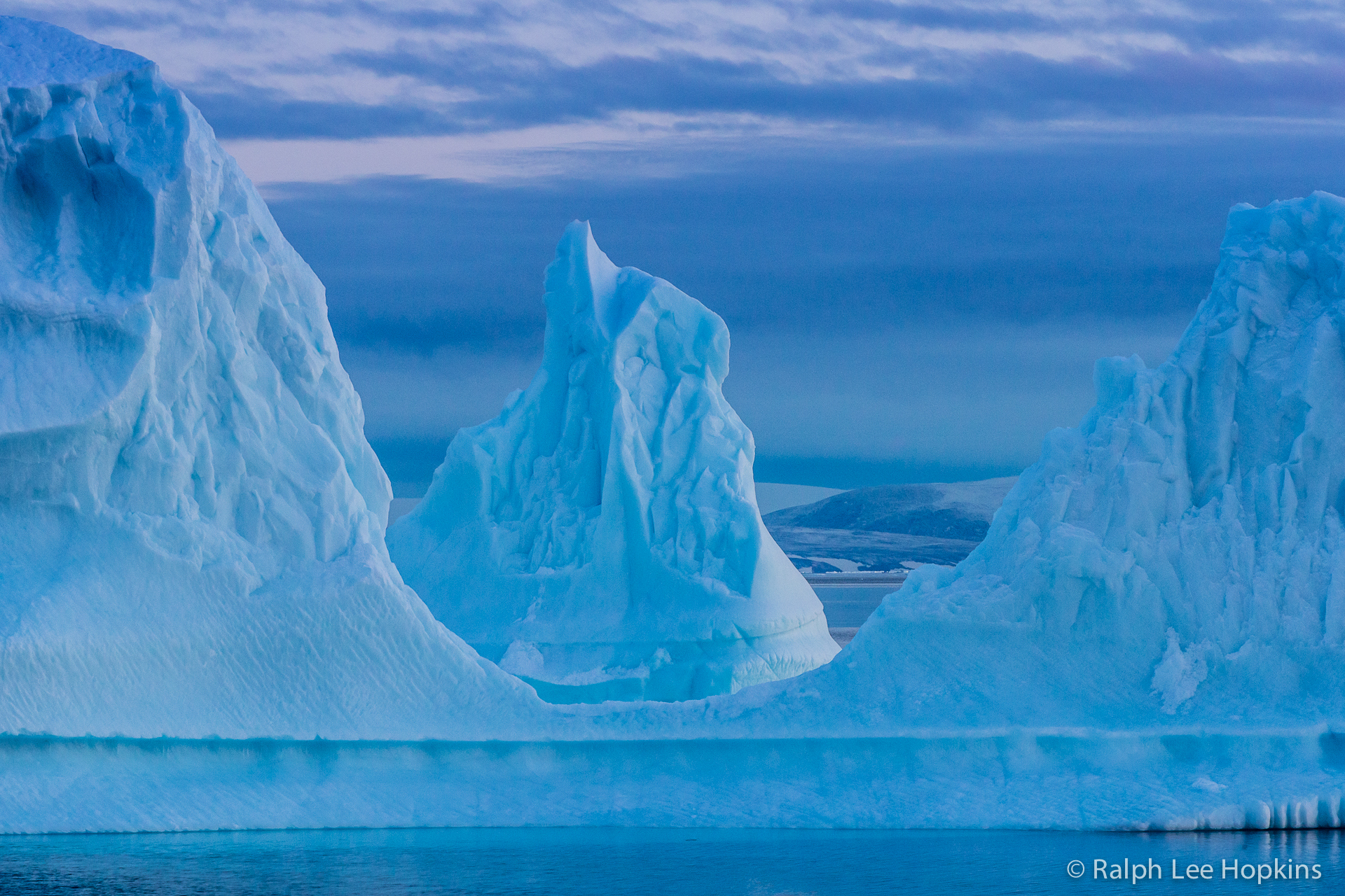
A triple-towered iceberg floats between Ellesmere Island and the Greenland coast.
At that latitude, above 78 degrees north, evidence of both Inuit people (called Skraelings by Vikings) and Viking visitors have been found. Greenland and Canada are only 30 miles apart up there, so it makes sense that Vikings tracing the coasts -- from Europe to Iceland to Greenland in a few hundred years -- would make the leap.
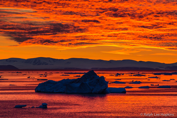
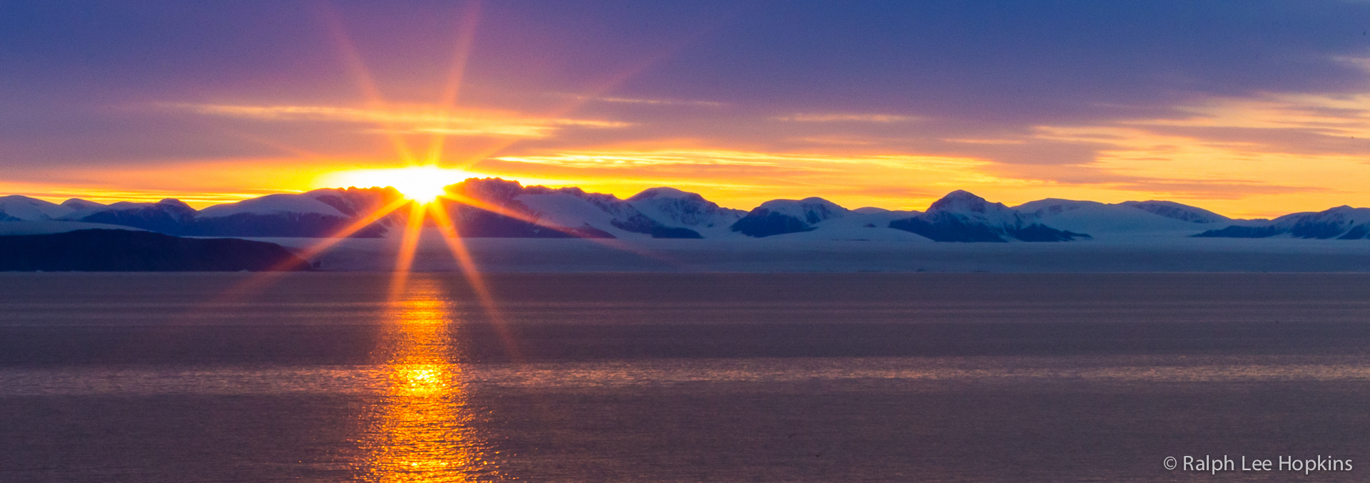
This sunset took hours to develop. When it peaked, we could hardly believe our eyes.
When we went ashore, the place came alive. Right from the beach we were surrounded by evidence of Inuit camp life: food caches, kayak racks, tent rings. Everything made from stone. It was easy to imagine people there, calling to each other, looking after sled dogs, heading out to hunt. And sometimes, the Vikings in their boats or camps not too far away.

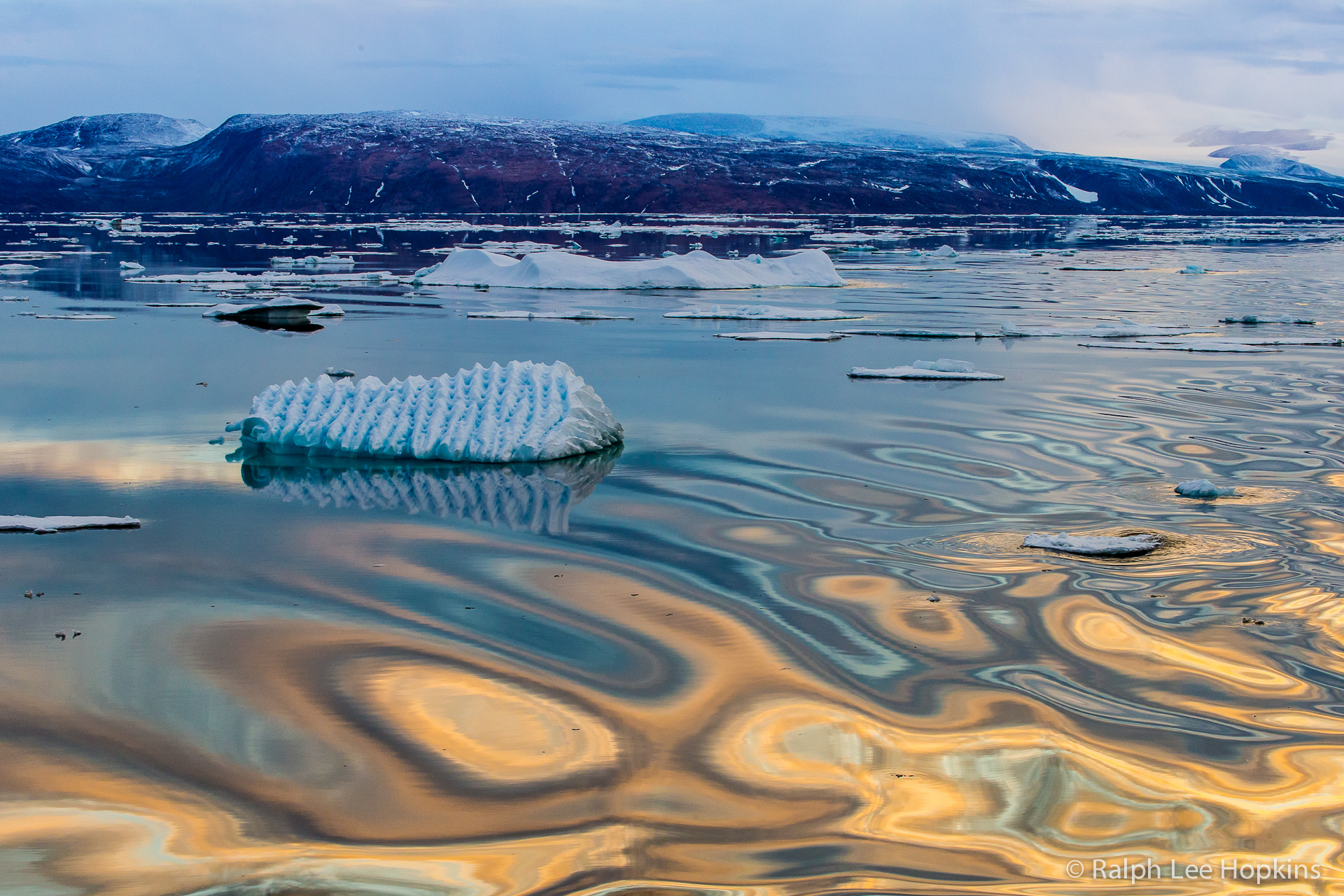
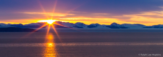
Reflections on the water gave our evenings a magical feeling.
It's difficult to know the details of that history, but without taking an unexpected turn we would never have encountered it. We stayed as long as we could, until we could no longer avoid heading south.
The coast of Ellesmere Island, Canada's legendary northernmost island.
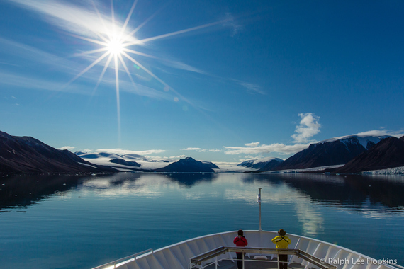
Our first approach into the fjord systems of Ellesmere; view from above the bridge on the National Geographic Explorer.
Photos by Ralph Lee Hopkins, Director of Expedition Photography for Lindblad Expeditions-National Geographic.
Our 2024 Coverage Needs You
It's Another Trump-Biden Showdown — And We Need Your Help
The Future Of Democracy Is At Stake
Our 2024 Coverage Needs You
Your Loyalty Means The World To Us
As Americans head to the polls in 2024, the very future of our country is at stake. At HuffPost, we believe that a free press is critical to creating well-informed voters. That's why our journalism is free for everyone, even though other newsrooms retreat behind expensive paywalls.
Our journalists will continue to cover the twists and turns during this historic presidential election. With your help, we'll bring you hard-hitting investigations, well-researched analysis and timely takes you can't find elsewhere. Reporting in this current political climate is a responsibility we do not take lightly, and we thank you for your support.
Contribute as little as $2 to keep our news free for all.
Can't afford to donate? Support HuffPost by creating a free account and log in while you read.
The 2024 election is heating up, and women's rights, health care, voting rights, and the very future of democracy are all at stake. Donald Trump will face Joe Biden in the most consequential vote of our time. And HuffPost will be there, covering every twist and turn. America's future hangs in the balance. Would you consider contributing to support our journalism and keep it free for all during this critical season?
HuffPost believes news should be accessible to everyone, regardless of their ability to pay for it. We rely on readers like you to help fund our work. Any contribution you can make — even as little as $2 — goes directly toward supporting the impactful journalism that we will continue to produce this year. Thank you for being part of our story.
Can't afford to donate? Support HuffPost by creating a free account and log in while you read.
It's official: Donald Trump will face Joe Biden this fall in the presidential election. As we face the most consequential presidential election of our time, HuffPost is committed to bringing you up-to-date, accurate news about the 2024 race. While other outlets have retreated behind paywalls, you can trust our news will stay free.
But we can't do it without your help. Reader funding is one of the key ways we support our newsroom. Would you consider making a donation to help fund our news during this critical time? Your contributions are vital to supporting a free press.
Contribute as little as $2 to keep our journalism free and accessible to all.
Can't afford to donate? Support HuffPost by creating a free account and log in while you read.
As Americans head to the polls in 2024, the very future of our country is at stake. At HuffPost, we believe that a free press is critical to creating well-informed voters. That's why our journalism is free for everyone, even though other newsrooms retreat behind expensive paywalls.
Our journalists will continue to cover the twists and turns during this historic presidential election. With your help, we'll bring you hard-hitting investigations, well-researched analysis and timely takes you can't find elsewhere. Reporting in this current political climate is a responsibility we do not take lightly, and we thank you for your support.
Contribute as little as $2 to keep our news free for all.
Can't afford to donate? Support HuffPost by creating a free account and log in while you read.
Dear HuffPost Reader
Thank you for your past contribution to HuffPost. We are sincerely grateful for readers like you who help us ensure that we can keep our journalism free for everyone.
The stakes are high this year, and our 2024 coverage could use continued support. Would you consider becoming a regular HuffPost contributor?
Dear HuffPost Reader
Thank you for your past contribution to HuffPost. We are sincerely grateful for readers like you who help us ensure that we can keep our journalism free for everyone.
The stakes are high this year, and our 2024 coverage could use continued support. If circumstances have changed since you last contributed, we hope you'll consider contributing to HuffPost once more.
Already contributed? Log in to hide these messages.