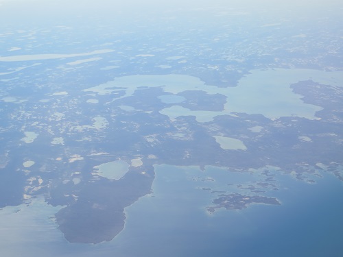
The flight from Norman Wells to Yellowknife, the Northwest Territories capital, on a Canadian North Boeing 737, with a nice polar bear on its tail, doesn't give you the close-up you get from the milk run's single prop plane, but you still get a good idea of the countless lakes and ponds gouged out by the ice age as the glaciers retreated.
There's no official figure, but there must be millions of them of all sizes, and you see a goodly number of them from 35,000 feet up. The Mackenzie River and the Great Slave Lake figure in the tales of Jack London but, the modern world being the modern world, Yellowknife now stars in one of the endless plagues of reality TV shows that now blight us - Ice Road Truckers.
The flight from Norman Wells
That's in winter of course.
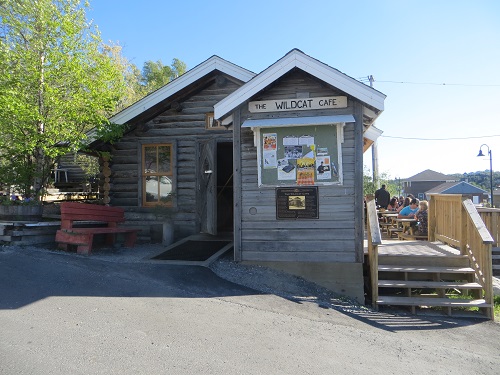
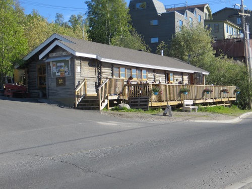
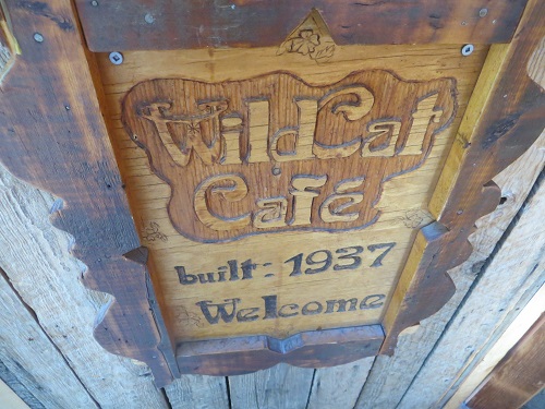
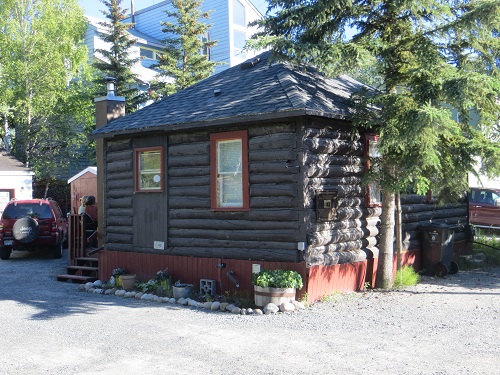
One of Yellowknife's most famous and oldest historic heritage sites is the Wildcat Café - that's cat café, you naughty kids, not cat house - built way back in all of 1937. By that reckoning, I'm prehistoric, predating the Wild Cat by a year.
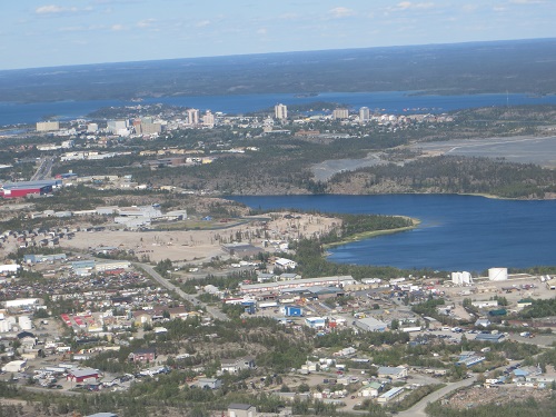
The town, 367 miles south of Norman Wells, was founded in the mid-1930s by prospectors who discovered gold in 'them thar hills,' or rather on 'them thar banks' of the northern arm of the Great Slave Lake, the 10th largest in the world at over 11,000 square miles.
The lake got its name not through any white-man nastiness, but from that of the Cree, who to show their disdain for the lake-bordering Dené called them weak and slaves. French fur traders translated the Cree into the French Esclaves, and the English followed suit with Slave, to the point that they are now called Slavey people, and their language Slavey, without any apparent derogatory intent.
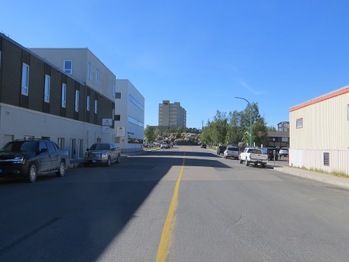
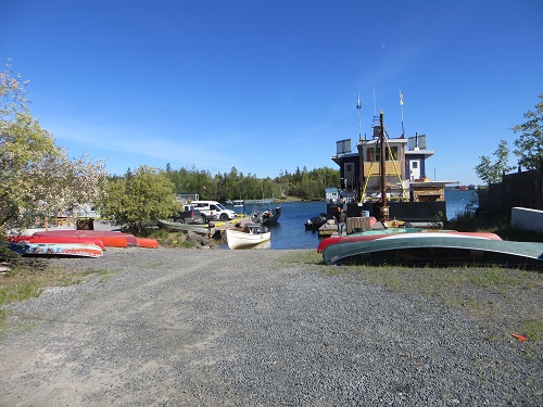
Yellowknife views


The city, home to some 20,000 people of all ethnicities, got its name from the Yellowknife Dené, thus christened for the copper knives they had wielded for centuries, although local indigenous people call it Somba K'e, Where The Money Is. If you visit the town's very helpful Visitor Centre they'll present you with a little yellow-knife pin to stick into, oh wherever you like.
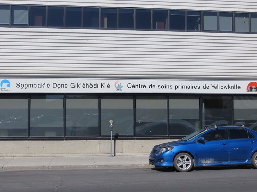
Slavey language signs
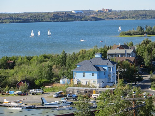
They suggest I visit Old Town, about a mile away, site of the original settlement on a spit of land. Have a drink on the deck of the Dancing Moose café and enjoy the splendid views of the lake's heavily wooded rocky bluffs, quoths they.
Views from Old Town near the Dancing Moose
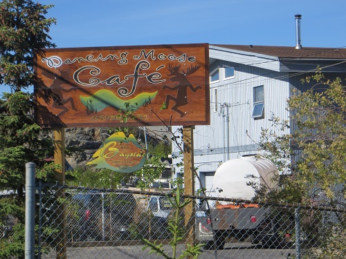

Well the Moose isn't dancing on this particular day in late June - it's closed - even if the bluffs are still rocky. That's how I end up in the Wildcat's log cabin. It's recently undergone some serious restoration.
Inside the Wildcat Café

It might not be old in the established use of the word, but Old Town's winding streets have a picturesque charm, as does the 1939 branch of the Bank of Toronto, a tiny log cabin sitting in the front yard of a family who now eats dinner on its back deck.
Bank of Toronto

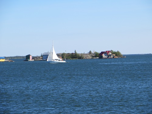
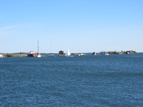
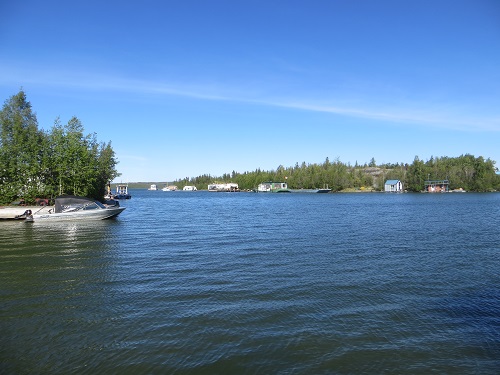
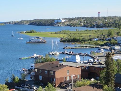
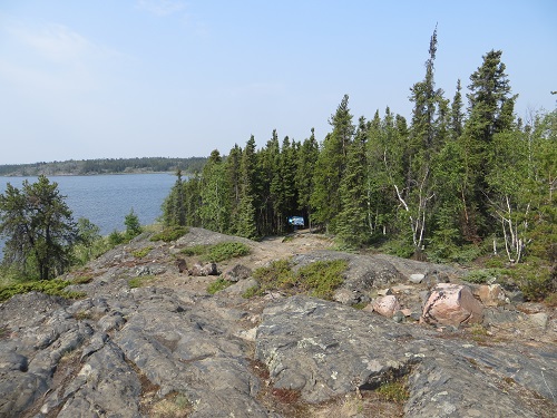
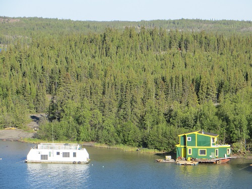
There are glorious views from Old Town's rocky hill across blue waters to float planes, yachts, forested shores and wood cabins set on tiny rock islets.
Gold petered out here some decades ago, to be succeeded by the discovery of fabulous diamond beds, and Yellowknife now styles itself the Diamond Capital of North America.
Views from Old Town hill


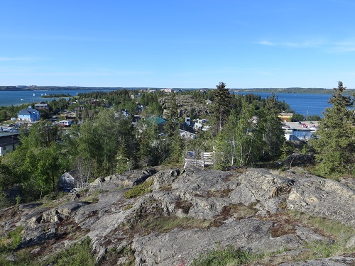
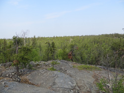
The town itself might not be old but the rocks on which it is built, the Canadian Shield, are among the oldest on earth at 2.5 billion to 3.5 billion years. What's more they were once mountains 39,000 feet high. But there you are, that's the wear and tear that comes with age - as I well know.
Thanks to the last ice age there's virtually no top soil, but forests of spruce and other trees still cling to the rocks for dear - and very verdant - life.
Trees springing from rocks

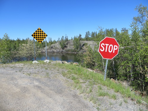
It's an enchanting panorama which you can view at your leisure if you take a car along Highway 4, part of a vast boondoggle dream of conservative Prime Minister John Diefenbaker way back in the 1950s to route hoped-for resources via his home province of Saskatchewan.
Well, it didn't pan out as planned, and a big stop sign on the brink of Tibbitt Lake, just 43 miles north, of Yellowknife brings you to a full stop. Those miles are called the Ingraham Trail, after legendary pioneer Vic Ingraham, also known as "Old Cedarfoot" for his creaky wooden leg - a necessity after a tug explosion left him drifting for two days on a rubber raft in an icy gale.
End of the Diefenbaker's boondoggle
In winter you can continue or turn off on several seasonal ice roads, something not lost on the wretched reality TV industry for their Ice Road Truckers, which locals say - surprise, surprise - hypes the possibility of the ice cracking.
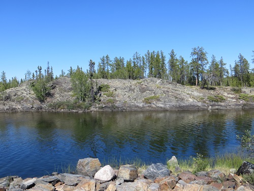
For more ancient reality entertainment, the Dené have for centuries identified a large sacred rock along the way where the Yellowknife River enters the Great Slave Lake as the massive dam built by giant beavers, which their hero Yamouri brushed aside to allow free transit. The tale has been handed down in oral tradition since the beginning of time.
Along the Ingraham Trail

OK, beavers don't build dams with giant rocks, but giant beavers did indeed exist, reaching seven feet in length and a weight of up to 270 pounds. They are believed to have become extinct 10,000 years ago. Does Dené oral tradition reach back all those millennia?
We know people lived around the lake way back then, and it's no more fanciful, perhaps, than what some of today's reality TV shows concoct.

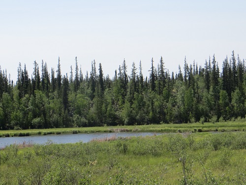
Near where river meets lake
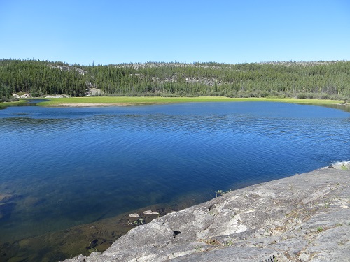
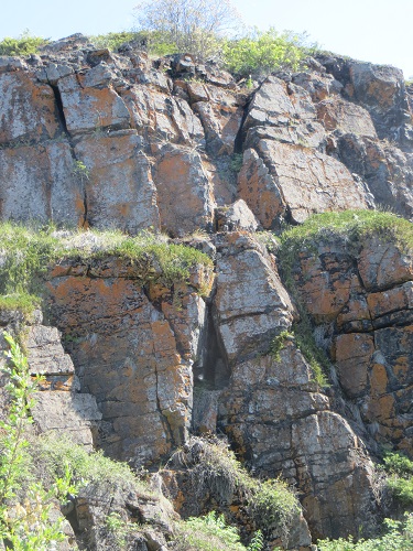
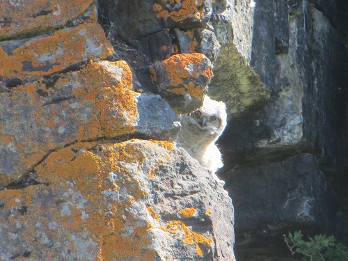
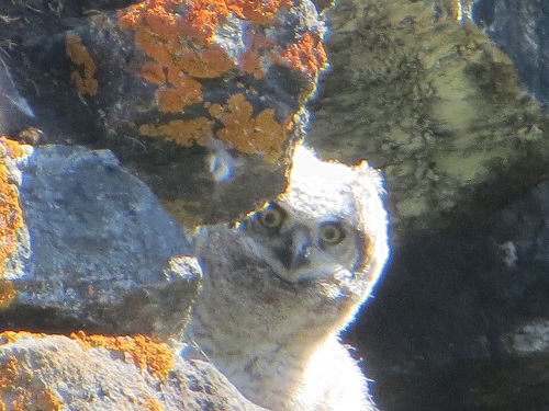
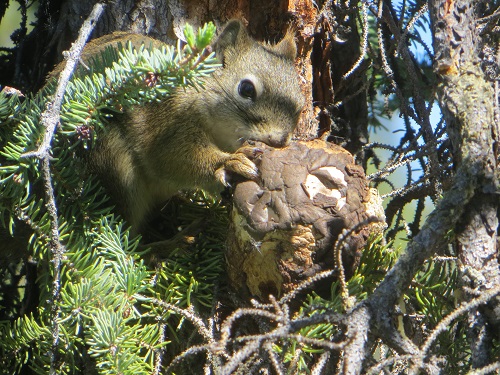
Other interesting features along the Ingraham include exhausted and abandoned gold mines and installations. On a nearby lake infant red grebe chicks are taking a ride on their mothers' backs, while a white owl chick stares out nonchalantly from its nest in a cleft in a cliff.
White owl chick
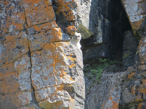

Getting in on the act
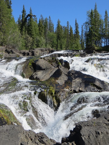
Not far from the trail the powerful and frothy Cameron River Ramparts waterfalls shushes down spruce carpetted rocks.
Cameron River Ramparts


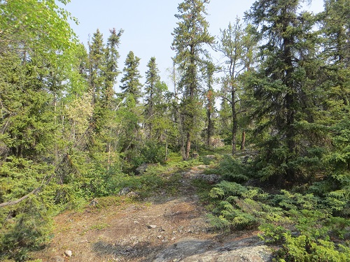
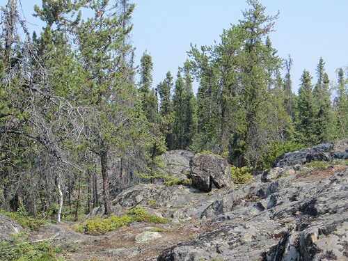
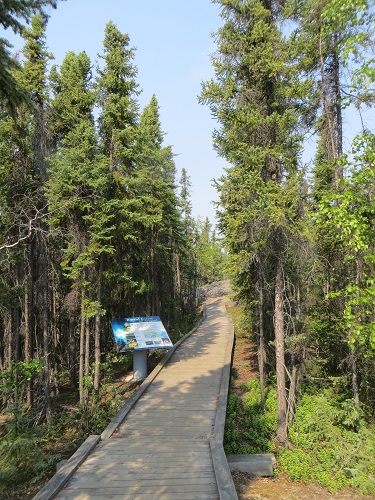
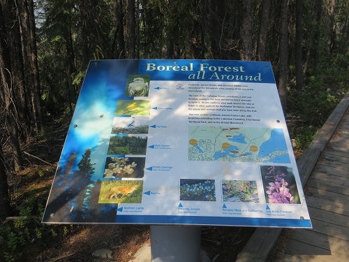
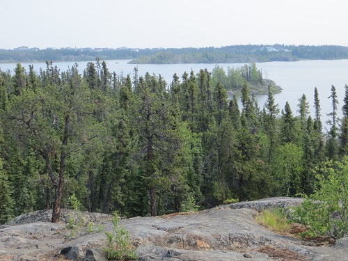
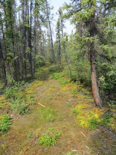
But you can enjoy wild nature right without leaving town where the Frame Lake offers a gloriously rugged five-mile elliptical hike through what is known as a boreal forest of deep green spruce and other trees on a carpet of wonderfully emerald mosses and yellow-green lichen.
Instead of sprouting out of the permafrost as these forests usually do, it rises out of the scant earth cover on pure grey rock. The contrast is enchanting.
Frame Lake trail
There are explanatory boards along the way, including one on black bears. They don't have the glaring, blaring red warnings of further north, although the garbage bins in town are bear-proof with little flaps on top that they apparently cannot get their claws under. The bins lean forward so that the lids will automatically slam shut in case some careless human forgets to close them.
Narrow blue dragonflies are flitting all over the place in the bright sunlight.
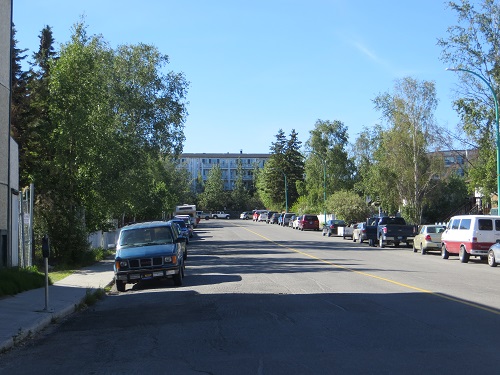
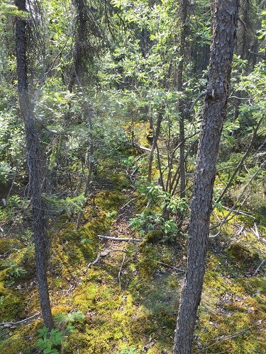
More views
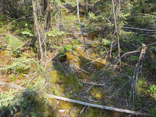
The hike leads along boardwalks, up wooden steps and stairs, and over huge boulders but there are red-topped posts to guide you over the rocks, so not even I can get lost, however hard I try.
And some more

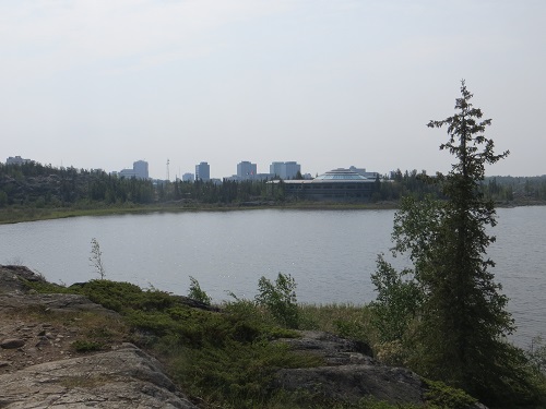
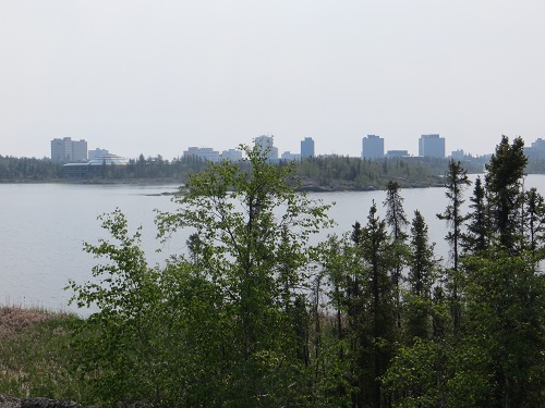
About half way round, the view changes somewhat as the industrial part of town comes into view on the skyline - unfortunate.

Change of horizon
And that's about it for these interminable blogs on my last full day in the Northland, as Jack London called these regions.
[Upcoming blog on Sunday: Now that the endless blogs on the summer trip are at an end, come along in real time and go bi-polar among the polar bears of Hudson Bay]
Forests of the Northland
______________
By the same author: Bussing The Amazon: On The Road With The Accidental Journalist, available with free excerpts on Kindle and in print version on Amazon.