


Satellite imagery
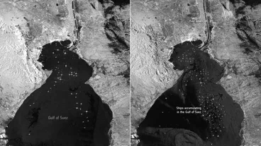
The backlog of boats is clearly visible from space.

The photos released by a website specializing in North Korea studies don’t say anything about the potential health problems of the country's leader.

The explosion marked the third failure involving a rocket at the Imam Khomeini Space Center, raising suspicion of sabotage.

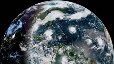
A shocking view of the power of a Category 4 hurricane.
WHAT'S HAPPENING


The powerful storm is expected to batter South Carolina’s coastline on Thursday.

Using satellite images of Lombok from the days after the quake, scientists measured the changes in the island's surface.

Photos released by satellite imaging company DigitalGlobe give a birds-eye view.