
The Waldo Canyon Fire, the most destructive wildfire in state history, burned so hot that wildfire experts say that nearly 20 percent of the total 18,247 acres (29 square miles) consumed by the blaze was burned so severely that no living vegetation was left on the surface nor root systems left below the surface to a depth of about 4 inches, The Associated Press reports.
The Burned Area Emergency Response (BAER) assessment team determined that 3,375 acres or about 5 square miles was determined to be damaged so badly, left so baren after the blaze ripped through the area that it was likened to moonscape, U.S. Forest Service hydrologist Dana Butler said.
(SCROLL DOWN FOR MAP OF BURN AREA, NASA IMAGE OF BURN SCAR AND SLIDESHOW)
BAER broke the burn severity of the soils and watersheds into three levels, besides the nearly 20 percent severely burned, the group found the remainder of the area to be 41 percent low or unburned severity (7,586 acres) and 40 percent moderate severity (7,286 acres), according to InciWeb.org
The Waldo Canyon Fire BAER assessment slideshow presentation of their findings can be viewed here.
The BAER team made recommendations to reduce the likelihood of erosion and flash flooding as well as strategies for regrowth in the Waldo Canyon burn area, 9News reported.
The U.S. Forest Service produced a map that depicts the Waldo Canyon Fire burn scar using various colors to illustrate the severity of burn around the burn scar. Red illustrates high severity, yellow moderate severity, blue low severity and green represents unburned areas.
Below that map is an image of the same area that NASA's Advanced Spaceborne Thermal Emission and Reflection Radiometer (ASTER) snapped aboard the Terra satellite on July 4th.
According to NASA Earth Observatory the bright red, which includes both visible and infrared light in the false-color image, represents unburned forest and vegetation. The light brown areas indicate areas where some burning took place and the dark brown areas indicate areas severely burned.
The Waldo Canyon Fire killed two people, destroyed nearly 350 homes, forced the evacuation of more than 32,000 people and was part of Colorado's worst wildfire season in a decade.
LOOK: Map of of soil burn severity via InciWeb.org and U.S. Forest Service. For a larger view of the map, click here.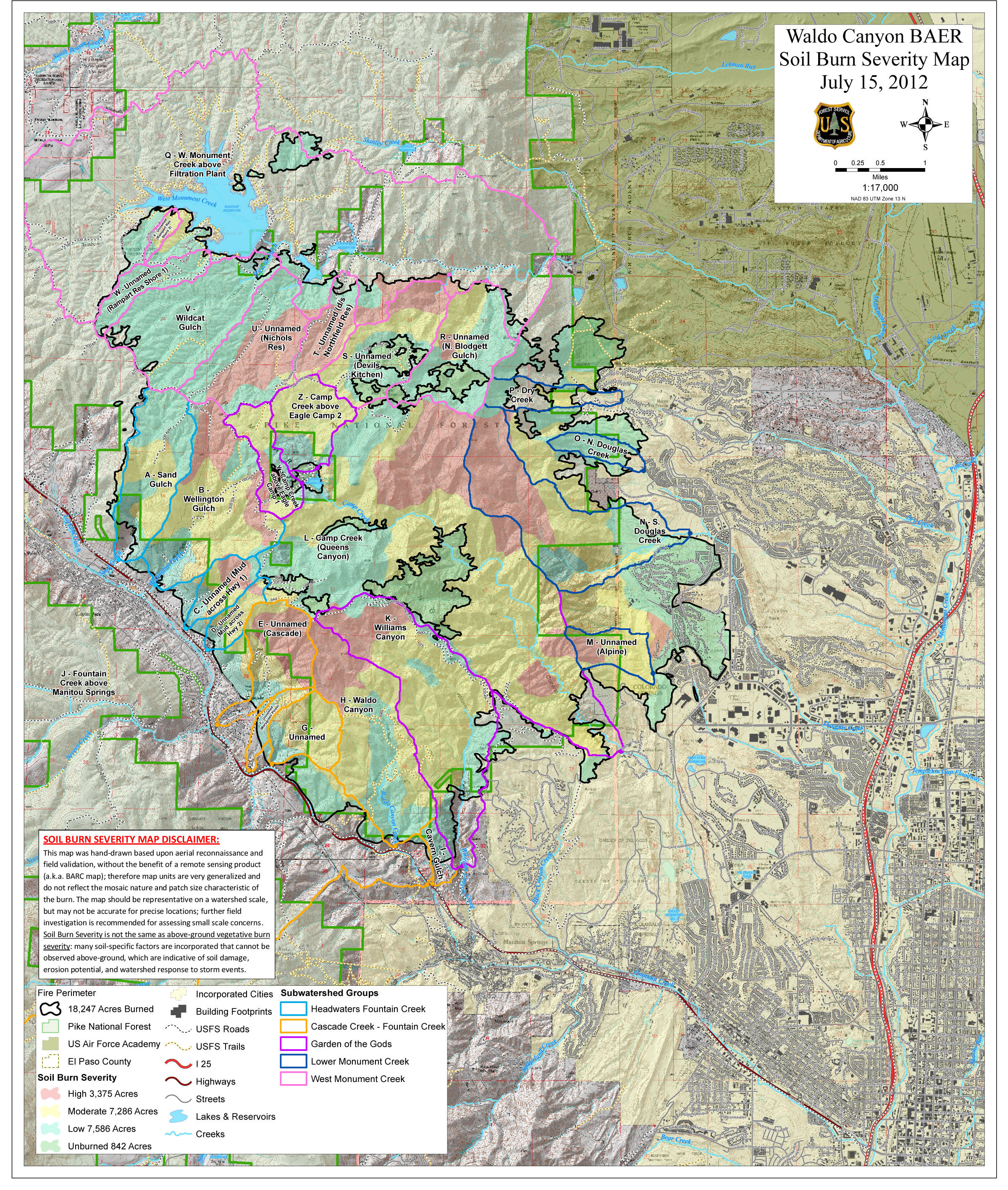
LOOK at satellite image of burn scar, via NASA Earth Observatory: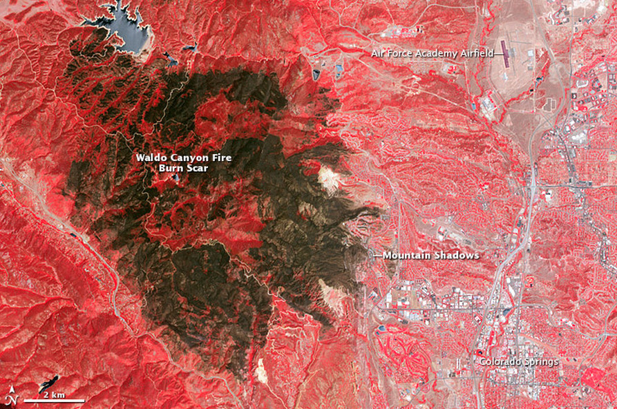
Additional photos of the Waldo Canyon devastation below:
Related
Before You Go
